Car-free hike - Crossing from Chamrousse to Vizille
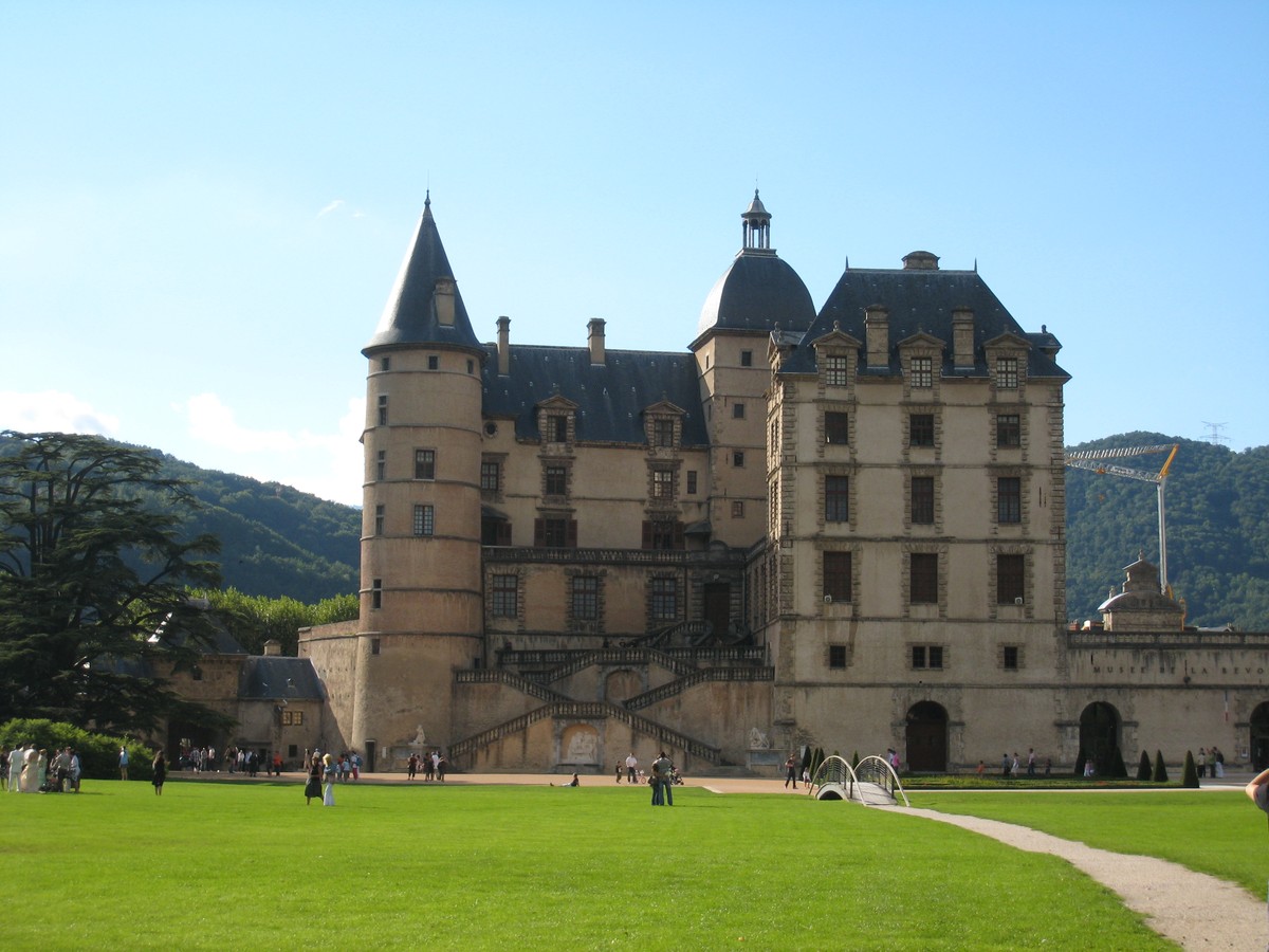
A descent to the Château de Vizille, through the different levels of the alpine forest, to discover a protected peat bog, with views of the mountains and their isolated hamlets.
Itinerary by public transport offered by Alpes Là.
Read more Read less
Start: Chamrousse 1750 (1744 m) - 50 min (2.9 km, D+ 25 m, D- 268 m)
At the north end of the shopping center, cross the crosswalk, then go down the stairs towards Le Recoin to get back to the main road. Opposite the Mairie (50 m to the north), take the path towards Lac Luitel, which joins the GR® 738.
Follow the GR® towards Lac Luitel: a track then a path leads to the Barraque de Boulac, located in a hairpin bend in the D111.
1) Barraque de Boulac (1495 m) - 35 min (2.2 km, D- 236 m)
Follow the road for 100 m, then take the right-hand path down to Lac Luitel. Cross the road (D111) and follow the path for a few meters to reach the lake's Exutoire, its northern end.
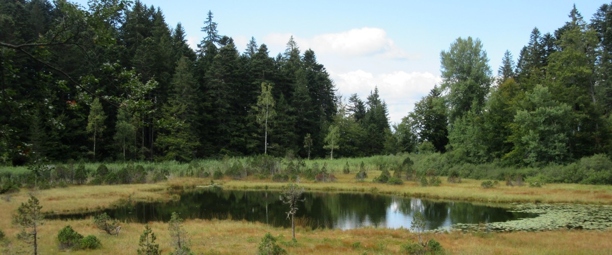
2) Lac Luitel - L'Exutoire (1259 m) - 1 h (0 km, D+ 139 m, D- 71 m)
Continue in the direction of Vizille and climb up to join the trail around the Pic de l'Oeilly to the north, which you follow as far as the Baraque Pagnot. Then take the track downhill (dir. SW) and arrive under the power line at the Eau Morel crossroads.
3) Eau Morel (1324 m) - 30 min (1.5 km, D+ 15 m, D- 174 m)
Turn left onto the track (dir. SE) which passes the Source de la Clobasse and its meadow, before descending to the Col de la Madeleine.
4) Col de la Madeleine (1165 m) - 30 min (1.8 km, D+ 16 m, D- 95 m)
Turn right (NW) towards Vizille (via Mont Sec) on a track that skirts the Madeleine hill. From the La Croisée crossroads, take a short climb up to the hamlet of Mont Sec (on the track, then the road) and cross it (on the road, then the path) until you reach a crossroads of marked paths.
5) Mont Sec (1078 m) - 30 min (1.5 km, D- 346 m)
Take the path leading to Montjean (right, dir. N), which descends a little steeply in places.
6) Montjean (738 m) - 1 h 20 (4 km, D+ 43 m, D- 501 m)
Descend the track to the hamlet of Allas. Follow the main road to the left (dir. W) to reach Vizille.
Just before the tunnel :
if the Parc du Château is open (gates), cross the park and exit via the main entrance to the Place du Château.
if the park is closed: cross the tunnel and turn left to reach the Place du Château.
Return to Vizille - Place du Château (281 m)
This is a car-free hike where you can take the bus to and from Vizille. Make sure you know the times and days of traffic before you leave.
Fontaine de Boulac (au niveau d'une cabane), fontaine de Mont Sec après le Col de la Madeleine

-
Car-free hike - Crossing from Chamrousse to Vizille
Arrêt transport en commun Roche Béranger - Avenue du Père Tasse
Chamrousse 1750
38410 CHAMROUSSE
Route
- Languages: Fr
Rates
Free access. Public transport ticket price at your expense.
Opening periods
From 01/05 to 31/10.
Hike to do in summer season, presence of late snow.
Subject to favorable snow and weather conditions.
Equipments and characteristics
- Pets refused
- Parking
Access
Aller depuis Gare de Grenoble vers Chamrousse : bus Cars Région T87, arrêt Chamrousse 1750 - Roche Béranger (durée 1h15 min)
Retour arrêt Vizille Place du Château vers Gières : bus M TAG 23, arrêt Gières Gare (durée 30 min)
- Latitude: 45.109858
- longitude: 5.875382
Environnement
- Close to a public transportation
- Bus stop < 500 m
Track characteristics
- Distance:
- 16 km
- Positive level difference:
- 220 m
- Daily duration:
- 5h 30min
- Level:
- Level red – hard
- Type:
- One way


