Chemins du Soleil - Les contreforts du Vercors
You've got to earn your way to the Vercors!
Sometimes in the undergrowth, sometimes in open areas with beautiful views over the eastern crests of the Vercors, the final stretch is a long descent to Les Cochettes and Villard-de-Lans,
Read more Read less
Seen from below, it's easy to understand that, starting at an altitude of 200 metres, the climb to Saint-Nizier-du-Moucherotte, perched at 1,170 metres, is no simple warm-up! It starts out pleasantly enough, in the Vouillants woods, which are popular with Grenoble residents for walking and mountain biking. The rest is a question of courage! The finish at Saint-Nizier offers a breathtaking view of the Alps and the valley. A pause at the orientation table is a must.
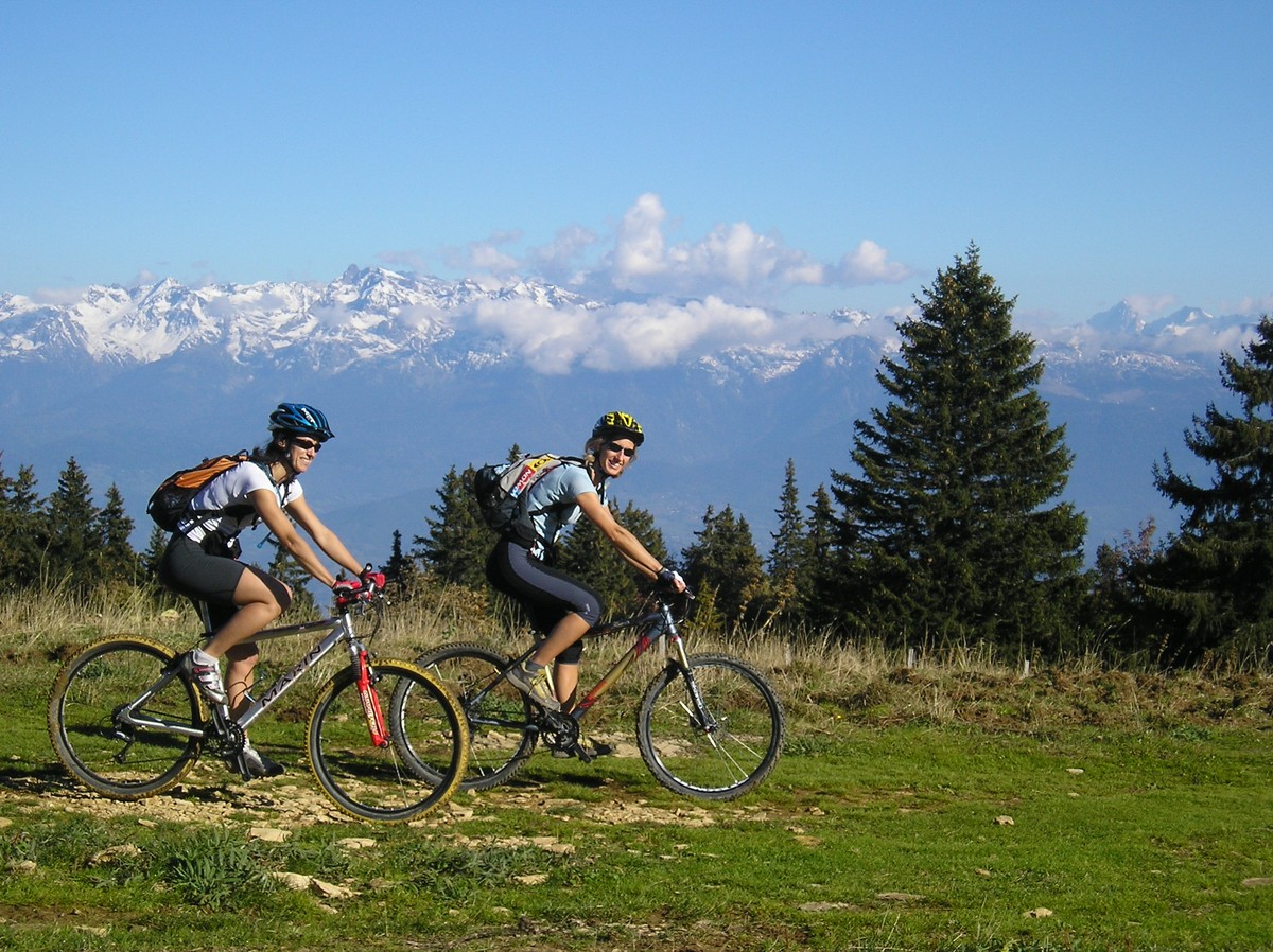
Once at the top, the Vercors plateaus are not all that flat, even if this part of the Chemins du Soleil is quite "rolling".
You'll find yourself in the special atmosphere of the Vercors, between cliffs, meadows, fir trees, beech trees and living spaces. On a fairly varied profile, the rolling trail overlooks the magnificent Furon and Bruyant gorges, then leads into the Val de Lans, with a breathtaking view of the Grande Moucherolle, the second-highest peak in the Vercors.
From Lans en Vercors, a fine ascent starts from Les Bruyères. The reward is a breathtaking view over the Val de Lans, followed by a long single-track descent. As you approach Villard-de-Lans, a renowned Vercors health resort, the route offers a varied landscape of limestone cliffs, wooded slopes and meadows.
-
Chemins du Soleil - Les contreforts du Vercors
38000 GRENOBLE
Route
- Languages: Fr
Rates
Free access.
Opening periods
All year round.
Subject to snow conditions.
Equipments and characteristics
- Pets refused
Track characteristics
- Distance:
- 46 km
- Positive level difference:
- 1571 m
- Daily duration:
- 7h 45min
- Type:
- One way
