Circuit VTT entre Jarrie et Champ sur Drac
This tour takes you by mountain bike or mountain biker on a 19 km loop between Jarrie, Champagnier and Champ sur Drac. Most of the route is on roads, and you'll have to climb to reach the Champagnier plateau.
Read more Read less
Park near Jarrie station, Allée de la Croix de la Vue. You'll start this tour with a stretch of road.
Start out on rue Frédéric Manhès, and when you reach the crossroads go straight on over the Madeleine bridge to Champ-sur-Drac. At the next intersection, turn right and continue straight ahead.
Pass the Musée Autrefois. It presents family life, industry, crafts and agriculture in the 19th century.
At the intersection, turn right and cross the Romanche again. At the traffic circle, continue straight on towards Clos Jouvin in Jarrie. Turn left, then immediately left to take the road leading to Prieuré des Charbonneaux. Leave the road on the left to join the path leading up to Saut du Moine.
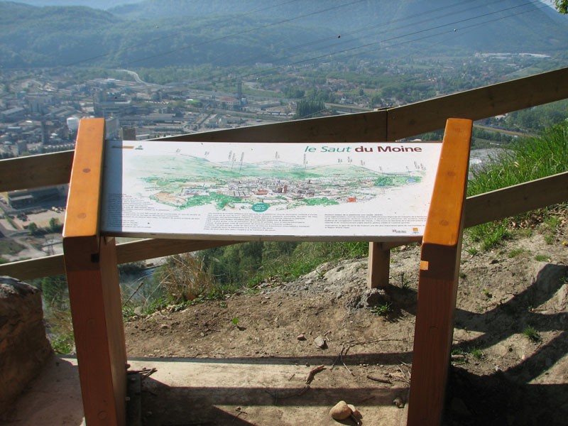
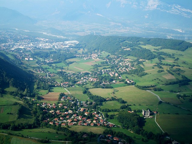
This is the most challenging part of the route, with the path leading up to the Saut du Moine lookout. At the summit, you can see part of the Drac valley and the junction with the Romanche, as well as the Belledonne and Connex mountains.
A reading table presents the legend that gave the promontory its name.
Take the path towards Champagnier, which slopes gently down to the village. After the Mairie (town hall) you're back on a road, turn right towards the Jarrie Regional Nature Reserve. Continue straight on, then turn right again towards the Nature Reserve. When you reach Jarrie, turn left at l'Aragna. At the Plâtre crossroads, turn left onto Route du Plâtre and drive past the Nature Reserve.
Leave the road on the path that goes straight ahead and continue to make a wide loop around the nature reserve, passing through the Frettes forest. Back in Jarrie, at the Plâtre crossroads, turn left away from the Nature Reserve and head for the Château de Bon Repos. At the next intersection, turn left onto Route de Mollard. Continue straight ahead on Route du Mollard and cross the D112 to reach Route de Bon Repos. At the bend in the road, you'll see the Château de Bon Repos. Go straight ahead and start to climb.
Follow the Chemin de Rampeau, then turn right. In the housing estate, turn left onto Route de la Combe. Follow the mountains up towards Les Chaberts and Croix de la Vue. At the crossroads before the Croix de la Vue, turn right and head back down to Jarrie. From here, return to your starting point on the Bouchassey trail.

-
Circuit VTT entre Jarrie et Champ sur Drac
38560 JARRIE
Route
- Languages: Fr
Rates
Free of charge
Opening periods
Throughout the year : open daily.
Equipments and characteristics
- Pets allowed
Track characteristics
- Distance:
- 19 km
- Positive level difference:
- 230 m
- Level:
- Level bue - Medium
- Type:
- Loop


