La Pinéa - Sommet
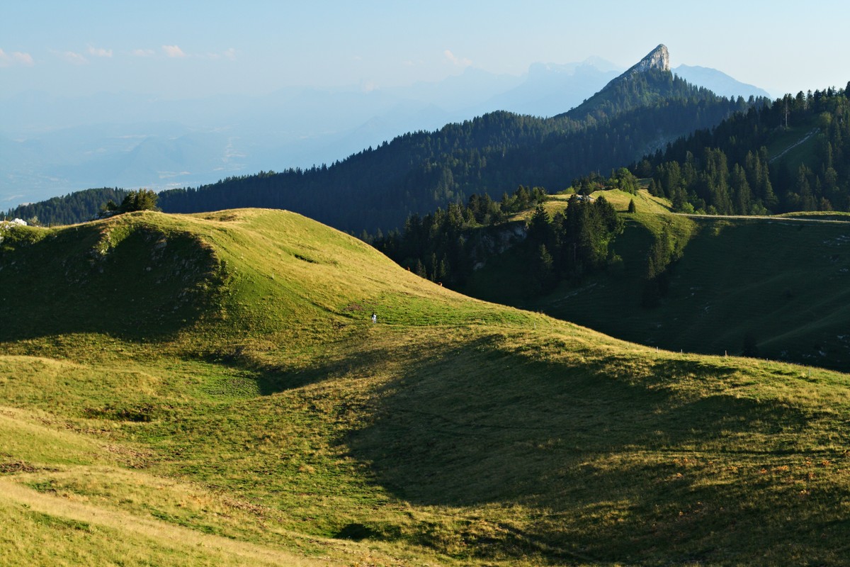
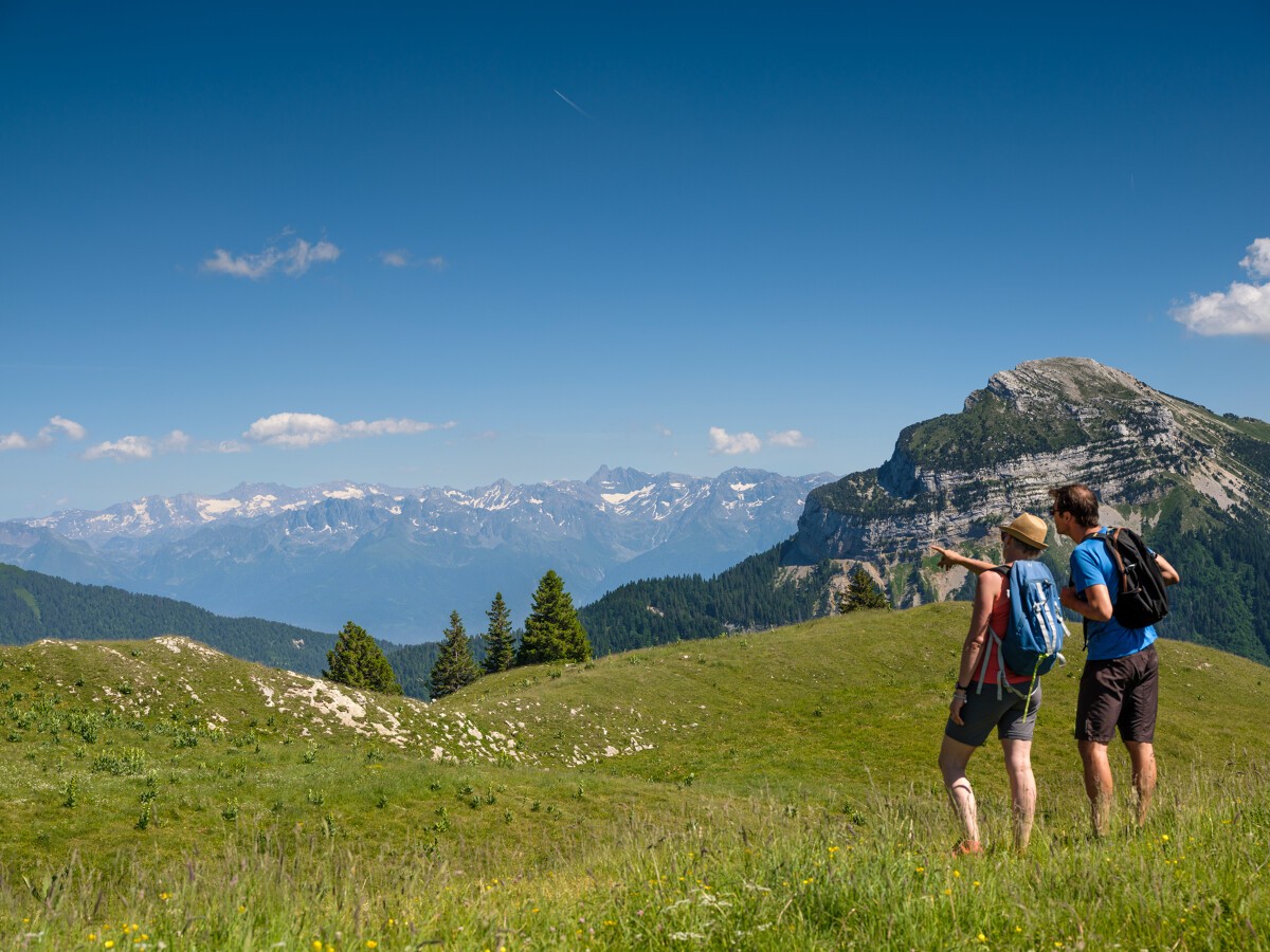
La Pinéa (1771m) isn't the biggest peak but she teases her neighbours, le Charmant Som and Chamechaude. This aerial summit offers an authentic mountain hiking, with an easy to reach and magnificent 360-degree view.
Read more Read less
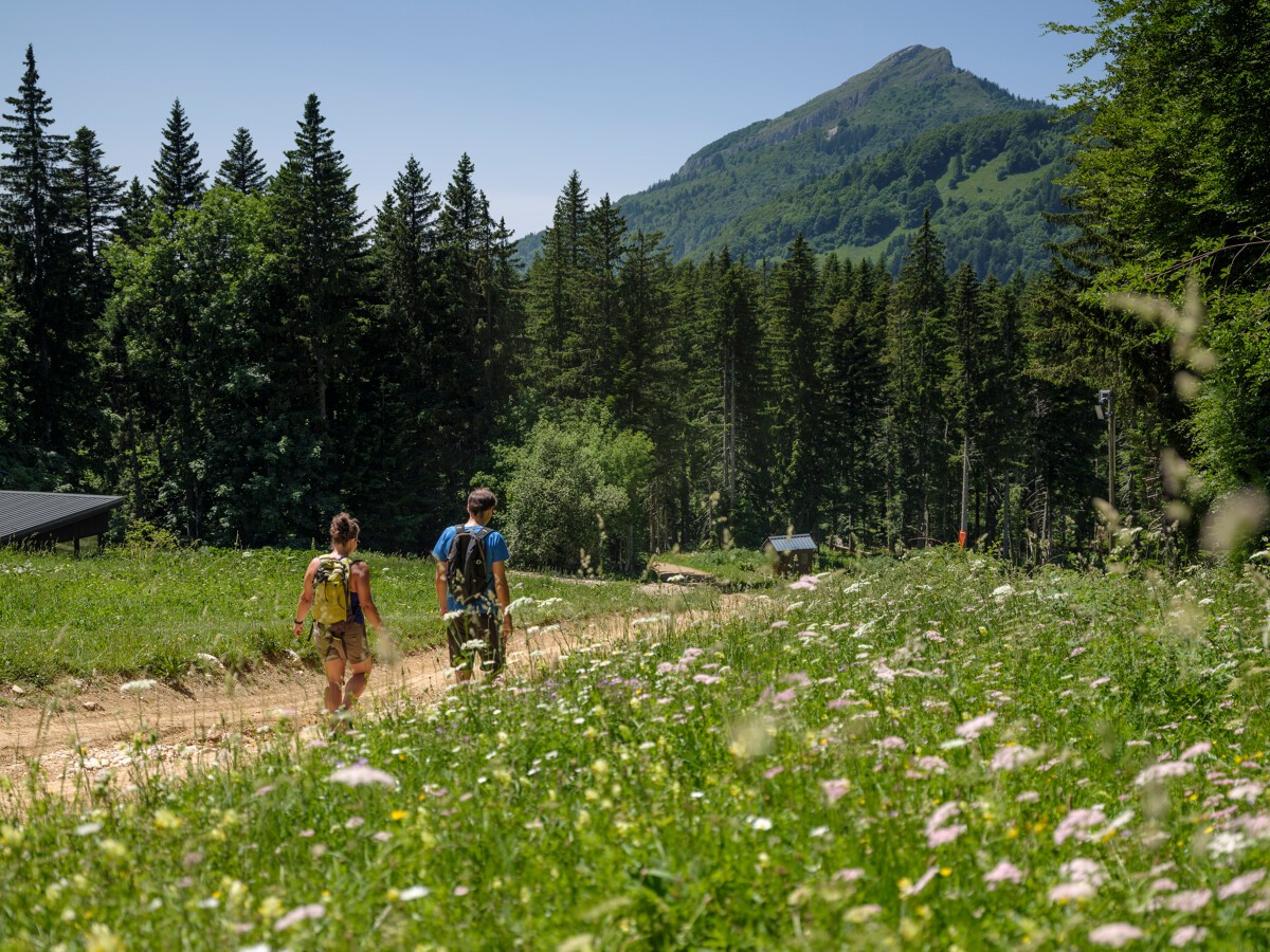
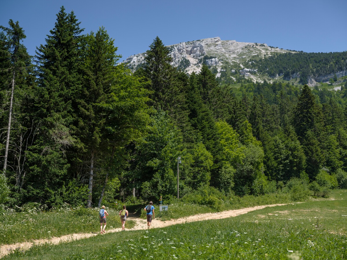
From the Col de Porte, drive to the Habert du Col de Porte, 600m in the direction of the Chalets du Charmant Som, at the first parking lot.
On foot, take from La Prairie a wide forest road on the left. Follow the GRP Tour de Chartreuse (marked yellow and red) to Plénom and passing by Les Frettes. Leave the GRP to reach La Pinéa in a final effort before enjoying the panorama from the summit. The last steps are a bit aerial, so be careful to watch children or people prone to vertigo, especially when approaching the West cliff, on the opposite side of the climb. The return is done by the same route.
To see / to do near the route :
- La Casamaures (16km from the start): exhibitions and shows.
- Fort du St Eynard (9km from the start) : visit of the fort and exceptional panorama.
- Museum of Contemporary Sacred Art (7km from the start): church of St Hugues.
- Grande Chartreuse Museum (10km from the start): audio-guided visit
All the information and other ideas of visits on chartreuse-tourisme.com/rsf
Information / safety :
- it is advisable to adopt some rules and to follow some advices to fully enjoy your walks and hikes in complete safety! Before leaving, follow our recommendations and advice on chartreuse-tourisme.com/advice-rando-trail (or on request in the tourist offices).
- Note: the mountain leader is a specialist in mountain fauna and flora, off-trail hikes away from the crowds, local history, alpine and rural traditions, etc. in complete safety! Call on them! Detailed list on chartreuse-tourisme.com/accomp (or in the tourist offices).
- You hike under your own responsibility. Chartreuse Tourisme and the tourist offices cannot be held responsible for the proposed itineraries.
Useful numbers :
- Meteo (to be consulted imperatively before your departure) : 3250 or www.meteo.fr
- Mountain rescue : 112
-
La Pinéa - Sommet
Col de Porte
38700 SARCENAS
Route
- Languages: Fr
Rates
Free of charge.
Opening periods
From 01/05 to 30/11.
Equipments and characteristics
- Pets allowed
Access
ACCÈS BUS : ligne Flexo 62 arrêt “Col de Porte“
- Latitude: 45.289754
- longitude: 5.767091
Track characteristics
- Distance:
- 7 km
- Positive level difference:
- 450 m
- Daily duration:
- 3h
- Level:
- Level bue - Medium
- Type:
- Round-trip
See also
-
Les 3 Sommets - Restaurant
View more

