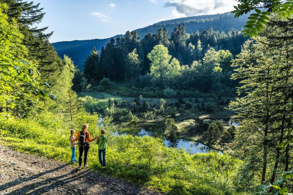
The tour of the Pic de L'Oeilly
In the south of Belledonne, the Luitel pass keeps the traces of the ancient glaciers.
This easy hike around Œilly is a trip back in time with the vestiges of
with the vestiges of the rural life of yesteryear.
Read more Read less
From the parking lot, take the direction of the Maison de la réserve and the Luitel lake, pass a small bridge, to reach in 2 minutes the Maison de la réserve (alt. 1 262 m). Then take the climb to the left of the building, following the yellow markings. You overhang the road on your right, then join a big track that you continue straight ahead. After having passed the viewpoint overlooking the Luitel lake and the explanatory panel on its formation, you arrive at the sign Lac Luitel (alt. 1 280 m). Continue on the large trail towards the foot of the pic de l'Œilly. You now follow the white and red markings of the GR 738, the GR de la Grande Traversée de Belledonne. At the foot of the pic de l'Œilly (alt. 1350 m) (attention unsealed sign) continue on the GR, to the right, towards the baraque Pagnot. At the baraque Pagnot (alt. 1 380 m) (attention: broken and down sign) you are on a large crow's foot. Turn right, on the track which goes down, and which leads you by the long distance path to the col de la Madeleine, passing by Eau Morel. At Eau Morel (alt. 1,333 m), just after the high voltage line, turn left towards the source of La Clobasse. Be careful, after a more open portion, to take the path that goes to the right and that abandons the track. You will arrive at the source of La Clobasse (alt. 1,330 m), and follow the direction of La Roche, 1.14 km away. At La Roche (alt. 1,150 m), go back and forth on your right to reach the col de la Madeleine
and its orientation table from where the view on the Taillefer is of great beauty. Back to La Roche, you leave the GR to follow the yellow markings in the direction of the Luitel lake by Buissonnière. The path leads you to old buildings where you take, on the left, a beautiful path going up, lined with dry stone walls. At La Cime de Cherley (alt. 1,220 m), turn right. After a small descent, you reach a slight flat spot and a crossroads. Be careful not to take the path that goes immediately to the left, but to continue straight ahead for a few meters to find a wider track that goes to the left. This long downhill slope takes you to the hamlet of Buissonnière (alt. 1080 m). Continue straight ahead to go up towards the Luitel lake. You will reach the road that goes down to Séchilienne, a road that you will follow on the left for about 20 meters, to take the path on the right on the opposite side. Follow the yellow markings for a more straightforward ascent that brings you back to the road. You just have to take it uphill to reach your starting point at the parking of the Maison de la Réserve naturelle du Luitel (alt. 1 262 m).
Points of interest :
- The Natural Reserve of Luitel
- The Luitel lake
- The old hamlets
- The viewpoint of the Madeleine pass
- The forest
- The meadows
Départ : Parking Réserve Naturelle du Luitel
Les chiens sont acceptés sur le sentier mais pas dans la Réserve Naturelle du Luitel
Balisage jaune

-
The tour of the Pic de L'Oeilly
Départ : Parking de la Réserve Naturelle du Luitel
38220 SÉCHILIENNE
Route
- Languages: Fr
Rates
Free of charge
Opening periods
Throughout the year : open daily.
Equipments and characteristics
- Pets allowed
Access
PARKING : à droite après la maison de la Réserve naturelle du Luite
- Latitude: 45.087431
- longitude: 5.848422
Environnement
- In a nature reserve
- Mountain location
- Close to GR footpath
- Forest location
Track characteristics
- Distance:
- 9 km
- Positive level difference:
- 400 m
- Daily duration:
- 3h 20min
- Level:
- Level bue - Medium
- Type:
- Loop


