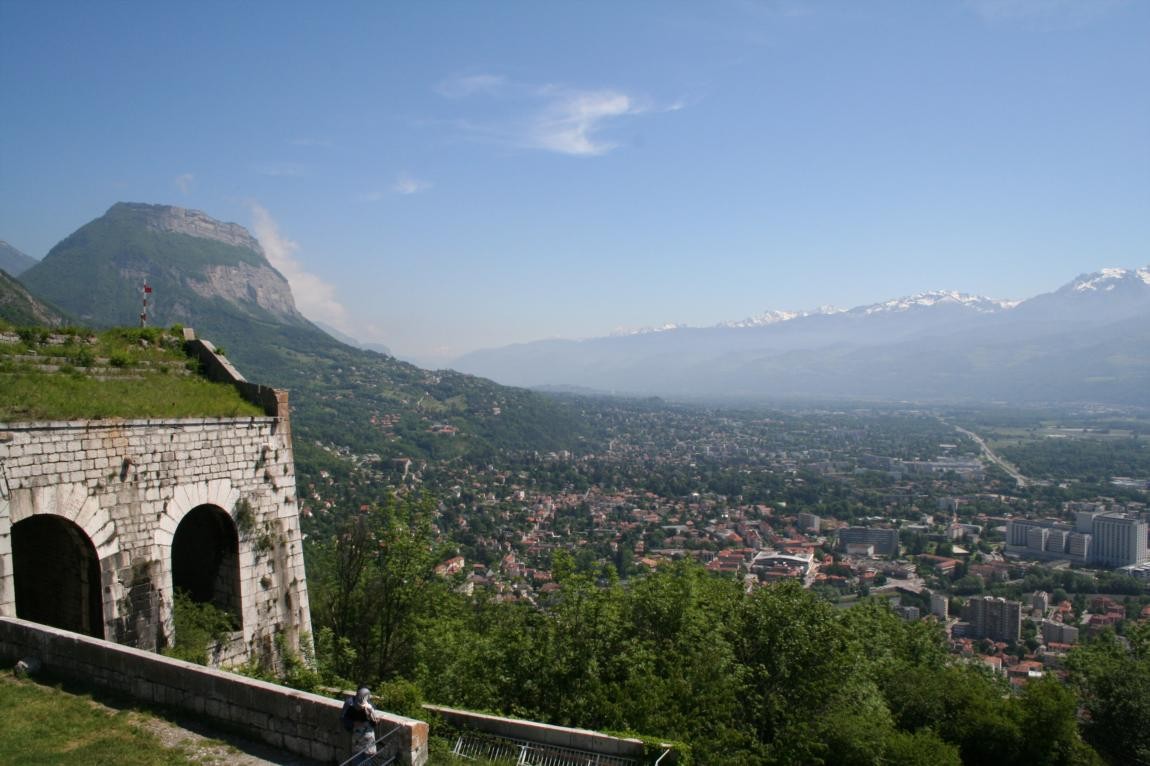
The Bastille and Saint-Eynard forts
The discovery begins with a splendid view of Grenoble from the Bastille and ends at the Fort du Saint Eynard. This monumental work of art offers an incomparable spectacle of the surrounding mountains.
Read more Read less
Park in the parking lot of l'Esplanade at La Porte de France in Grenoble. Departure from the top of La Bastille (accessible by cable car). From La Bastille plateau follow the GR9. Go through Mont Jalla and under Mont Rachais and follow the direction of Le Sappey until Col de Vence. Once in Sappey-en-Chartreuse, the route runs between two houses. 200 meters further, take the peaceful road that goes up to Pilonnières. At the crossroads of the Fort du Saint Eynard road, turn left then join the main road (Croix de Saint Bruno). After 200 m, leave it to follow a secondary road which passes at the foot of the ski lifts. From the left, you then come to a large car park located in front of a gîte. From the Col de Vence, follow left for 100 m on the Sappey road. Then turn right onto the path that climbs in regular laces to the Fort du Saint Eynard. Go around the fort to the left along the ditches until you reach the main entrance. The Fort du Saint Eynard is literally one with the rock. We discover a splendid panoramic view of Grenoble, 1000 meters below
-
The Bastille and Saint-Eynard forts
Départ : sommet de la Bastille
38000 GRENOBLE
Route
- Languages: Fr
Rates
Free access.
Opening periods
All year round.
Subject to favorable weather.
Equipments and characteristics
- Pets refused
Access
Cartoguide : Cartoguide des sentiers des franges vertes de l’Agglomération grenobloise / IGN TOP 25 n°3335OT Grenoble
- Latitude: 45.198744
- longitude: 5.725497
Track characteristics
- Level:
- Level black - very hard
- Type:
- Round-trip
Good deal
Vous découvrirez le mémorial des Troupes alpines qui culmine au sommet du Mont Jalla à 635 m.
Vous pouvez aussi vous restaurer au restaurant d’altitude du Saint Eynard, où l’on sert une cuisine montagnarde à toute heure de la journée.


