Lac des Quirlies - hiking
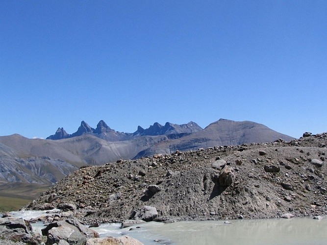
This is a varied hike featuring waterfalls, a green valley, lake, glaciers and panoramic views over the summits of the Grand Sauvage, Aiguilles d'Arves, Meije and the Girose glaciers.
Seguir leyendo Voir moins
A hike along the Ferrand river, crossing high-altitude pastureland (Cabanes des Bruyères and Chalets des Quirlies). Option of searching for crystals at the Clos Chevaleret.
TECHNICAL INFORMATION
Starting point: Le Perron car park
Elevation gain: 1000 m
Duration: 4 hours
Distance:14.8 km
Level: Difficult
MAP
OBP no. 3 (Oisans au Bout des Pieds): paths nos. 332 and 334
IGN Top 25 no. 3335 EST
DURING THE HIKE
- Pont Ferrand and its waterfall
- The glacial Quirlies lake (source of the Ferrand)
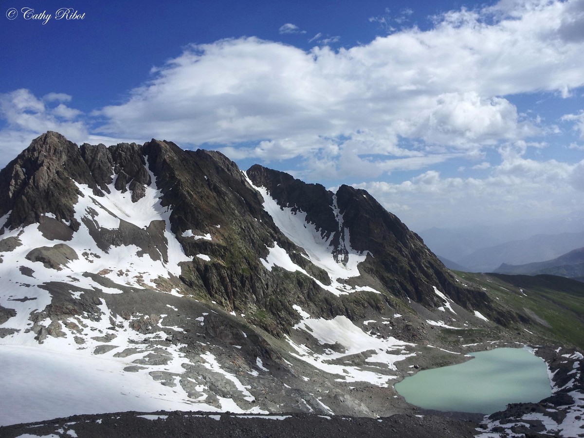
- The Malatres and Quirlies glaciers and their medial moraine
- The Echine de Praouat (a schist ridge)
EXTRA INFO
The Lac des Quirlies sits at an altitude of 2566 m and is fed by the glacier of the same name, which pours ice-cold milky water into the lake (the water is full of fine particles of clay giving it the milky appearance). The lake emerged around 50 years ago, bearing witness to the receding glaciers, and is now around 400 m long, although in the middle of the last century, it was just a pond. Indeed, on the first 1/50000 "Ecrins-Dauphiné" maps, the lake isn't even shown.
-
Lac des Quirlies - hiking
38142 CLAVANS-EN-HAUT-OISANS
Itinerario
- Idiomas: Fr
Tarifas
Acceso libre.
Periodo de apertura
Del 01/05 al 31/10.
A reserva de buenas de condiciones de nieve y tiempo.
Instalaciones y características
- Mascotas rechazadas
Acceso
Park in the hamlet of Le Perron (on the hairpin bend) and follow the track towards the Pont du Ferrand, to the foot of the waterfall of the same name.
- Latitud: 45.100197
- Longitud: 6.164588
Características del recorrido
- Distancia:
- 14 km
- Posible desnivel:
- 1000 m
- Duración diaria:
- 4h
- Nivel
- Rojo
- Tipo
- Aller-retour
