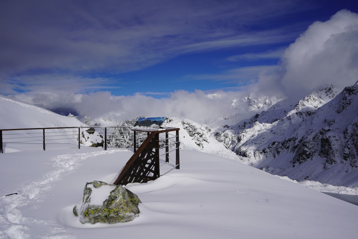
Chamrousse Belledonne viewpoint

Panoramic Park's Belledonne belvedere, close to the Croix de Chamrousse, the resort's summit.
Seguir leyendo Voir moins
In summer:
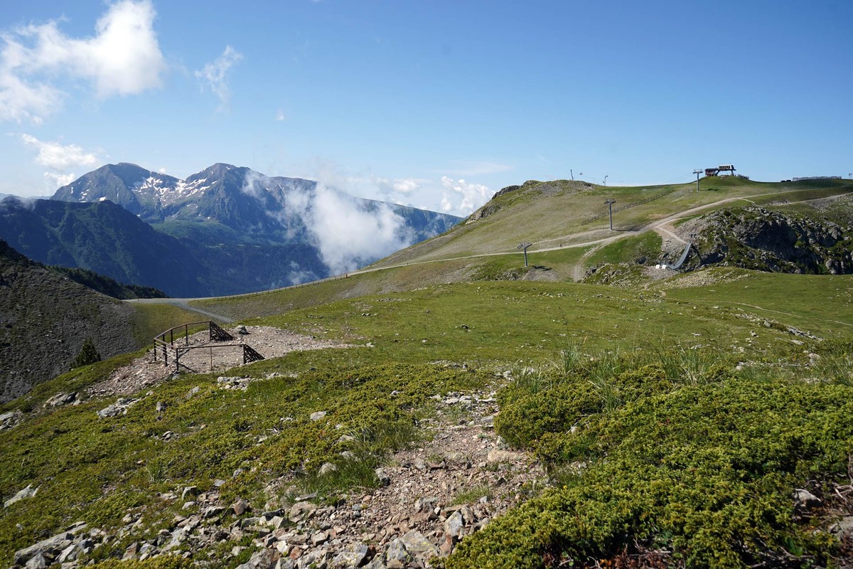
Access via the "Belledonne" pedestrian loop of the Croix de Chamrousse footpaths, at an altitude of approximately 2,250 metres:
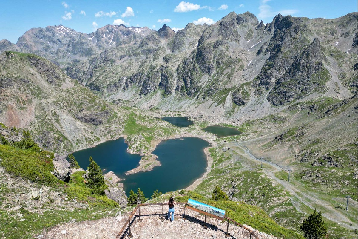
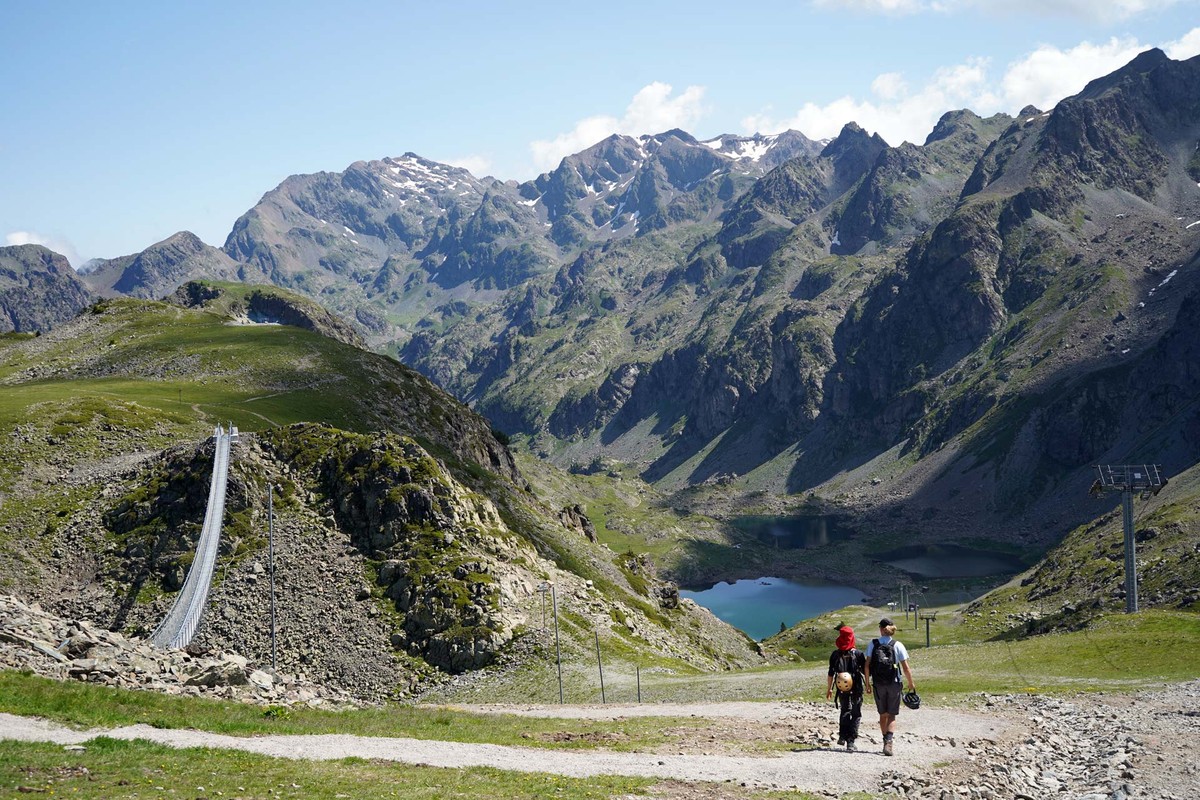
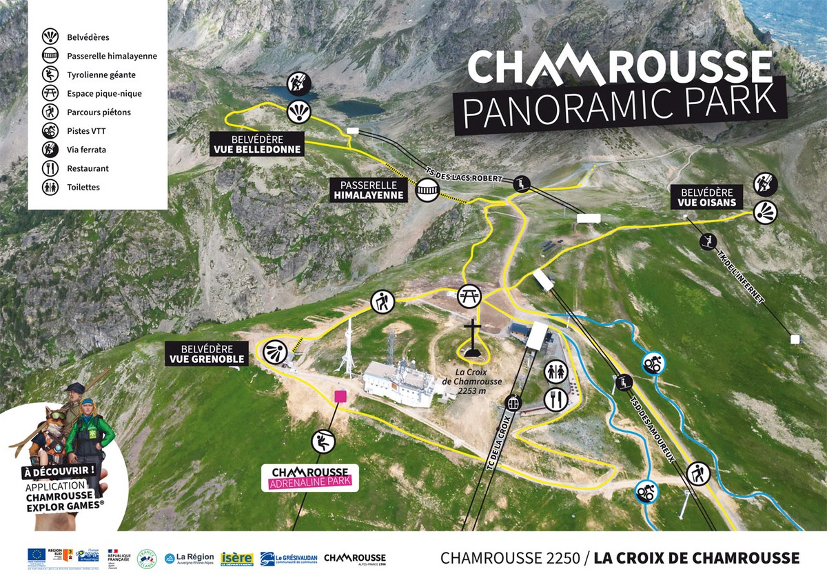
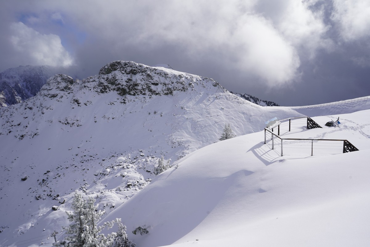
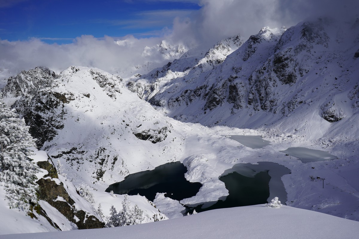
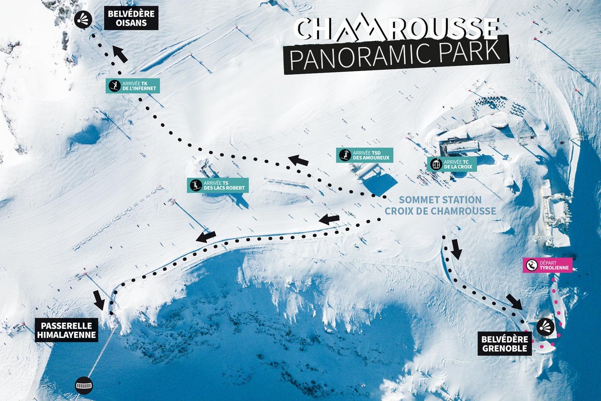
- Point of interest: panoramic view of the Belledonne mountain (Chamrousse at the southern tip), Himalayan footbridge and Belledonne lookout [to come].
- Distance: approx. 900 metres / Type of route: loop + out-and-back section / Difference in height: (information to come) / Duration: 40-45 minutes / Difficulty: blue - intermediate (beware of the vertiginous footbridge, but you can take the path below to avoid it if you are afraid of heights)
- Route: gondola > picnic area > himalayan footbridge (or an escape route if you are afraid of vertigo) > belvedere > himalayan footbridge (or escape route) > picnic area.
In winter: not accessible.
Easier access possible via the Croix gondola (paying): every day in the summer season (July-August) and at weekends only at the end of June and in September (subject to weather conditions).
-
Chamrousse Belledonne viewpoint
Croix de Chamrousse
Chamrousse 2250
38410 CHAMROUSSE
Itinerario
- Idiomas: Fr
Tarifas
Acceso libre.
Periodo de apertura
Del 29/05 al 30/09 todos los dias.
A reserva de buen tiempo.
Instalaciones y características
- Mascotas rechazadas
Acceso
From Grenoble: car or bus + gondola ascent or hike to La Croix summit + approach walk
Resort road access: Rocade Sud > exit no. 2 "Uriage" > Route départementale 111 (RD 111) Seiglières side.
Recommended parking: parking Henry Duhamel (P7), avenue Henry Duhamel (200 meters and about 2 minutes' walk - caution charge in winter).
Public transport :
Chamrousse 1650 - Recoin stop:
- regular bus service all year round: N93 (to/from Grenoble), "Chamrousse 1650" stop (merger of former T87, Transaltitude, Destination neige Skibus / nature Estibus 707).
Good to know - another stop less than 500m away (Place de Belledonne, near the Tourist Office):
- transportation by reservation during the week, excluding public holidays: Flexo 57 (to/from Uriage), "Chamrousse - Le Recoin" stop (former TAD TouGo - line G701)
- resort shuttle in winter: "Télécabine (1650)" stop (to/from Chamrousse 1750 - Roche Béranger and Chamrousse 1600 - plateau de l'Arselle/nordic area).
- Latitud: 45.125622
- Longitud: 5.905333
Entorno
- En montaña
- Estación de esquí
- Vista al lago
- Vista a la montaña
Para ver
-
Adrenaline Park - Chamrousse giant zip line
Más información

