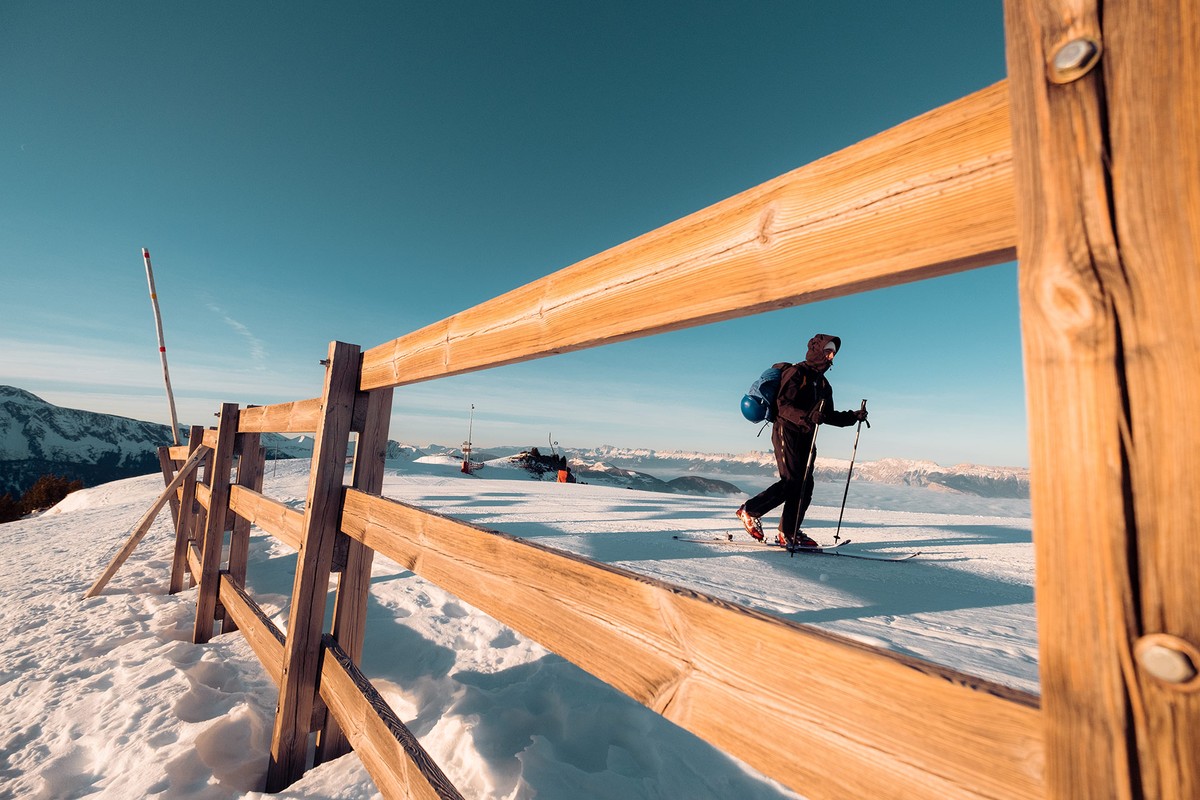
New start 24-25: Pont de Bachat-Bouloud - Croix de Chamrousse - not secured
Challenging ski touring ascent to La Croix, approx. 3.5 km and 630 m ascent.
⚠ New starting point: Pont de Bachat: put on your skis at the Ecrin chairlift, then join the other side of the piste.
Seguir leyendo Voir moins
Possible descent via downhill ski slopes (red or blue level).
Mainly forest and alpine route from the Bachat-Bouloud bridge.
Two escape routes are possible, one close to the Ours and the other close to the Crêtes alpine slopes. Conversion not compulsory but strongly recommended.
Tip: discover On Piste, an application and website to help you prepare and organize your ski touring outing or holiday, and track down the best addresses and events in sports destinations!
Free parking on route de Bachat-Bouloud or recommended 800/900 meters away on avenue du père Tasse.

-
New start 24-25: Pont de Bachat-Bouloud - Croix de Chamrousse - not secured
Route de Bachat-Bouloud
Chamrousse 1700
38410 CHAMROUSSE
Itinerario
- Idiomas: En Fr
Tarifas
Acceso libre.
Periodo de apertura
Del 02/12 al 14/04 de 8:30 a 18.
A reserva de buenas de condiciones de nieve y tiempo.
Instalaciones y características
- Mascotas rechazadas
Acceso
Public transport - main stop Chamrousse 1750 - Roche Béranger + 9 minutes approach time (or secondary stop Chamrousse 1700 - Village du Bachat + 5 minutes) :
- regular bus service all year round: N93 (to/from Grenoble), "Chamrousse 1750" stop [merger of former bus routes T87, Transaltitude and Destination neige Skibus / nature Estibus 707].
- bus line / shuttle on reservation weekdays excluding public holidays: Flexo 57 to/from Uriage [former TAD TouGo transport on demand - line G701].
- resort shuttle in winter: "Centre Commercial (1750)" stop (to/from Chamrousse 1650 - Recoin and Chamrousse 1600 - plateau de l'Arselle/nordic area)
Resort road access from Grenoble: Rocade Sud > exit no. 2 "Uriage" > Route départementale 111 (RD 111) on the Luitel side.
Recommended parking: main parking lot (P3), 390 avenue du Père Tasse.
- Latitud: 45.103591
- Longitud: 5.882633
Entorno
- En montaña
- Estación de esquí
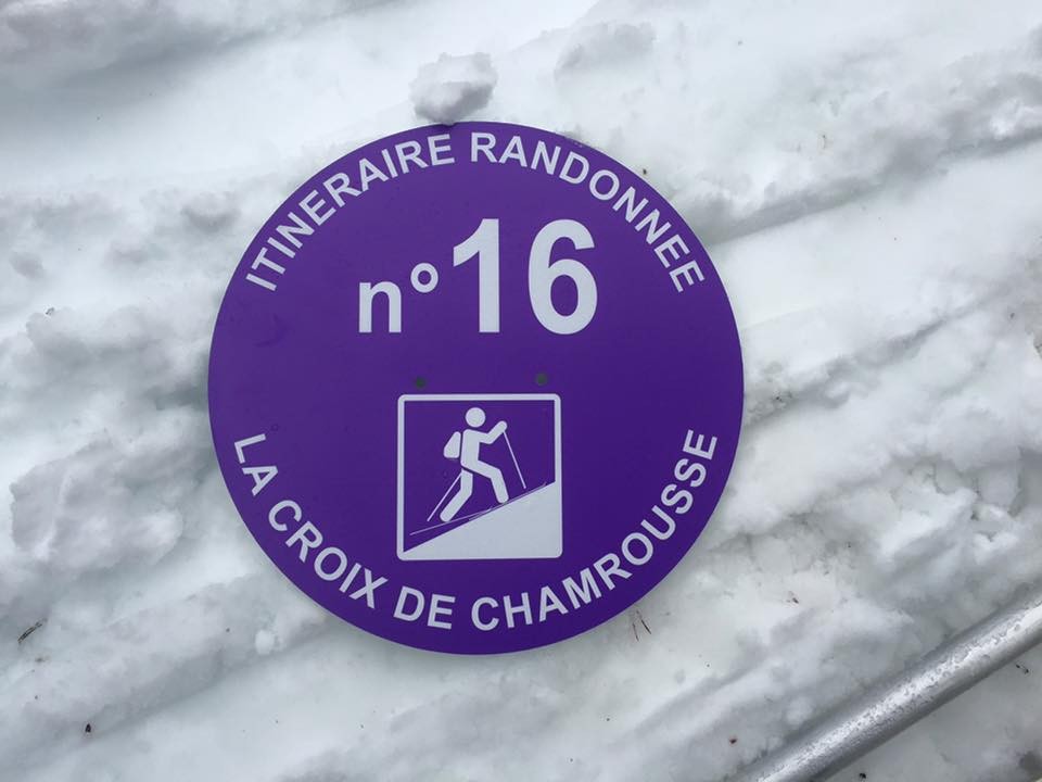
Características del recorrido
- Nivel
- Rojo
- Tipo
- Aller simple (itinérance)
Para ver
-
Adrenaline Park - Chamrousse giant zip line
Más información

