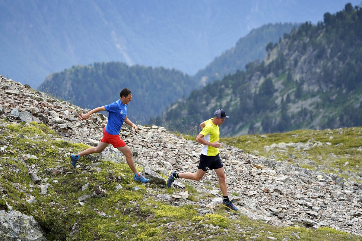
"Chamrousse-Belledonne lakes trails" running trail
One of the most beautiful mountain running track in Chamrousse. There, you could discover different mountain lakes. It is also the path for the famous event of "Trails of Belledonne - Chamrousse lakes" in July (TLCB)!
Seguir leyendo Voir moins
Departure: Tourist Office 1750 - Roche-Béranger.
Loop: Chamrousse 1750 – Achard lake – Robert lake – Pourettes lake – Vallons lake – Chamrousse 1750.
Let's discover the three natural mountain lakes in Chamrousse. It will be for your a guaranted change of scenery and viewing pleasure !
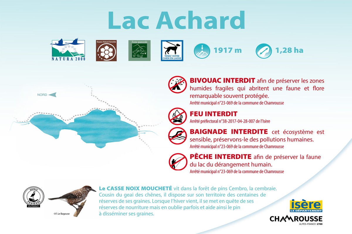
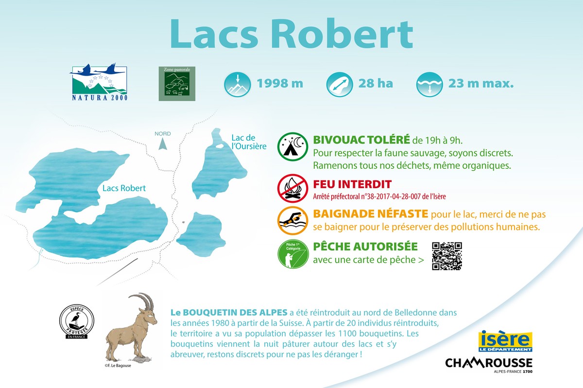
You can have a break around the lake Achard, in a Natura 2000 protected area* or next to the Robert lakes before to getting down the mountain till the Pourettes lake and direction le Recoin (1650m) finishing by the Vallons lake.
* In the Natura 2000 area making fire, setting a tent, fishing and swimming are striclty forbidden (under penalty). Bivouac is allowed from sunset to sunrise (except in July and August over-visitation period).
Please stay on trails to protect fragile areas.
Difficult running trail. Estimated running time for an average speed of 7km/h.
-
"Chamrousse-Belledonne lakes trails" running trail
Chamrousse 1750
38410 CHAMROUSSE
Itinerario
- Idiomas: Fr
Tarifas
Acceso libre.
Periodo de apertura
Del 15/06 al 30/09 todos los dias.
Instalaciones y características
- Mascotas rechazadas
Acceso
Road access from Grenoble: Rocade Sud > exit no. 2 "Uriage" > Route départementale 111 (RD 111) on the Luitel side.
Recommended parking: main parking lot (P3), 390 avenue du Père Tasse (approx. 100 m and 2-minute walk - pay attention in winter).
Public transport - Chamrousse 1750 - Roche Béranger stop:
- regular bus service all year round: N93 (to/from Grenoble), "Chamrousse 1750" stop [merging of former bus routes T87, Transaltitude and Destination neige Skibus / nature Estibus 707].
- bus line / shuttle on reservation weekdays excluding public holidays: Flexo 57 to/from Uriage, stop "Chamrousse 1750 - Roche Béranger" [former transport on demand TAD TouGo - line G701].
- Latitud: 45.109636
- Longitud: 5.875735
Entorno
- En montaña
- Estación de esquí
- Cerca de una parada de transporte colectivo
- Parada de autobús a menos de 500 m
Características del recorrido
- Nivel
- Rojo
- Tipo
- Boucle
Planes
Discovery of the natural altitude lakes, marmot observation, fishing in the "Lacs Robert" lakes, discovery of the alpine pasture and picnic tables in the middle.
