À la découverte des Arcelles
Discover the Frange Verte on the edge of town. 7 totems introduce you to the church and château, the Frise cellars, the Sabot lookout, the history of cooperage and the Tuilerie district. Topo on Les Sentiers de la Métropole.
Read more Read less
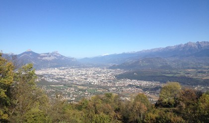
From this vantage point, on a clear day, you'll discover a panorama stretching from the Vercors to the Chartreuse.
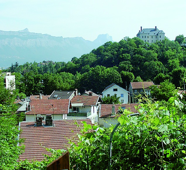
This easy, educational walk will introduce you to the Arcelles trail, a link between the historic village of Eybens and the nearby forest of Montavie hill. The itinerary is accessible to all, and 7 thematic totems will reveal a number of secrets. It starts on rue des Arraults, opposite the church, in the heart of the old village, nestled at the foot of the hill. A long flight of steps takes you high enough to admire the elegant 17th-century Château d'Eybens opposite, described by the 1st totem. A few metres further on, you're already in the middle of nature. A 2nd totem will tell you the story of the Friesian cellars. The next climb takes you to the Sabot belvedere. From here, you can enjoy a breathtaking view of the Grenoble metropolitan area, illustrated by a landscape-reading table. The walk continues by going a little deeper into the forest, which is mainly made up of deciduous trees, particularly chestnuts. The itinerary takes you from surprise to surprise, with totems telling the story of the cooperage, Eybens clays and tile-making, the famous road taken by Napoleon and the origin of the name Eybens. Near the Verderet bridge and the 7th totem pole, don't forget to pay a visit to the beautiful "tuffière" by taking the path on the left bank of the Verderet for a hundred meters or so. You'll learn all about the formation of this strange rock. At the end of the walk, take the Avenue de la République down to the Eybens church, your starting point.
-
À la découverte des Arcelles
Départ : Le Bourg
en face de l’église
38320 EYBENS
Route
- Languages: Fr
Rates
Free access.
Opening periods
All year round.
Equipments and characteristics
- Pets refused
Access
BUS ACCESS: line C4 "Eybens-le Bourg" stop
- Latitude: 45.147243
- longitude: 5.751757
Environnement
- Close to a public transportation
- Bus stop < 500 m
Track characteristics
- Level:
- Level green – easy
- Type:
- Loop
