De Venon au Champ de l’Eglise
Easy hike starting from Venon.
-
De Venon au Champ de l’Eglise
85 Chemin de l'Adret
38610 VENON
Route
- Languages: Fr
Step by step
Departure from Venon town hall parking lot. As soon as you leave the parking lot,
turn left as far as the Venon La Chappe sign. Cross the road and
turn right in the direction of Pré Bousson. Follow the
des Combasses to its junction with a track. Continue
straight on to the Les Grands Champs intersection. Continue towards
Sous Reyné and leave the chemin des Combasses by taking the path
left towards Champ Ruti. At an old
old building in Champ Ruti, take the left-hand path up to the
to the Champ de l'Eglise meadow until you reach the end of the road to
Venon. Turn left and follow the road to the hamlet of Le Chapon.
Shortly after crossing the hamlet, at Les Cochettes, take the wide
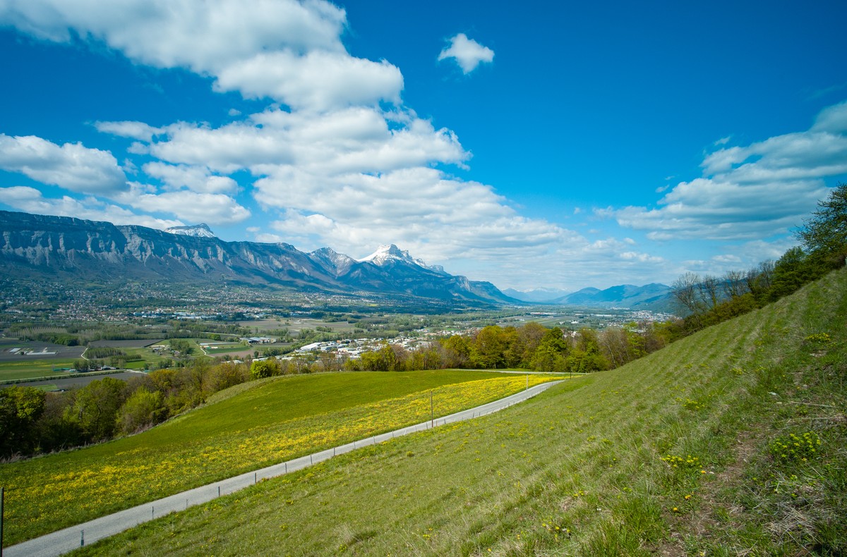
right towards Vallon des Puits, where hikers can contemplate
Grenoble, the Vercors and Belledonne.
Then turn left onto the Combeloup forest track and descend
to the barrier. Turn right onto the road to the hamlet of
Perroud. Cross the hamlet and continue straight downhill on the road
road and, at Sous Perroud, turn right onto the Pré Perroud road
Perroud to the right until it joins the main Venon road,
Cross the road and take the track opposite towards Pré Bousson. Take
left onto the Chemin des Combasses and return to Venon La
Chappe and return to the parking lot.
Rates
Free access.
Opening periods
All year round daily.
Equipments and characteristics
- Pets refused
Access
Parking à la mairie de Venon.
ACCÈS BUS : ligne 59 arrêt “ Venon Mairie “
- Latitude: 45.172330
- longitude: 5.804023
Track characteristics
- Distance:
- 6 km
- Positive level difference:
- 260 m
- Daily duration:
- 2 h 45 min
- Level:
- Level green – easy
- Type:
- Loop
