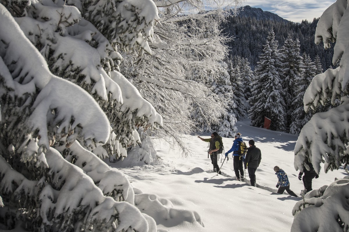
Snowshoeing trail: Pré Gaudet
Stroll in the forest where the magic happens after a beautilful snowfall, a real change of scenery !
Read more Read less
From:
- Chamrousse 1600 : 3h30 return 7km and 190m ascending elevation
- Chamrousse 1650 : 3h30 return 7km and 240m ascending elevation
Stroll in the forest where the magic happens after a beautilful snowfall, a real change of scenery !
Look for forest animal prints : roe deer, boar, squirrel, hare...
-
Snowshoeing trail: Pré Gaudet
Départ du parking du Vernon à Chamrousse 1650.
Chamrousse 1650
38410 CHAMROUSSE
Route
- Languages: En Fr
Rates
Free access.
Opening periods
From 01/12 to 15/04 daily.
Subject to snow conditions.
Equipments and characteristics
- Pets allowed
Access
Departure from the Vernon parking lot in Chamrousse 1650 - Recoin.
Public transport - Chamrousse 1650 - Recoin stop:
- regular bus service all year round: N93 (to/from Grenoble), "Chamrousse 1650" stop [merger of former T87, Transaltitude, Destination nature Skibus / Estibus 707].
Good to know - another stop less than 500m away (Place de Belledonne, near the Tourist Office):
- bus line / shuttle service by reservation on weekdays excluding public holidays: Flexo 57 (to/from Uriage), "Chamrousse - Le Recoin" stop [former TAD TouGo - line G701].
- resort shuttle in winter: "Télécabine (1650)" stop (to/from Chamrousse 1750 - Roche Béranger and Chamrousse 1600 - plateau de l'Arselle/nordic area)
Nearest stop: "Vernon" station shuttle bus stop.
- Latitude: 45.123542
- longitude: 5.877050
Environnement
- Mountain location
- Ski resort
- Close to a public transportation
- Near shuttle stop
Track characteristics
- Distance:
- 7 km
- Positive level difference:
- 240 m
- Daily duration:
- 3 h 30 min
- Level:
- Level red – hard
- Type:
- Loop


