The rock of Comboire - Family walk
Known for its ancient fort, the Comboire rock is an island of greenery protected from the galloping urbanization of the neighboring communes. This 2-hour loop marked out in yellow allows you to discover a rich natural and historical heritage.
-
The rock of Comboire - Family walk
Départ : arrêt de bus 21 ”Col de Comboire”,
38640 CLAIX
Route
- Languages: Fr
Step by step
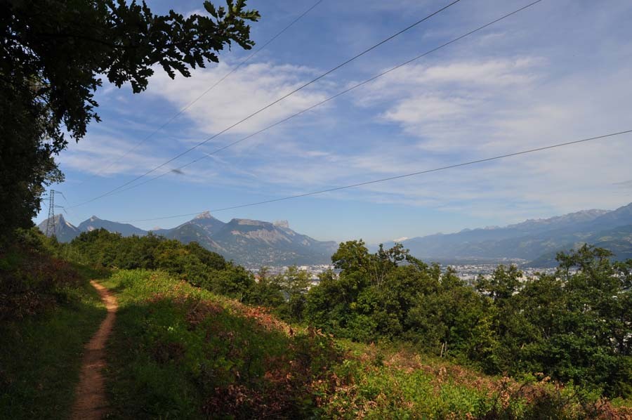
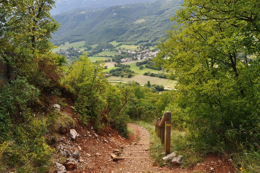
When you get off bus 58 at the "Col de Comboire" stop, you'll see a yellow sign indicating the direction to Les Cimentiers, which you'll follow. A hundred metres after leaving the road, turn right, heading south, to join the path leading up to "Les Cimentiers", towards the Belvédère de Comboire. You'll need to climb a hundred metres or so on a fairly steep path to reach the top of the rock. Depending on the season, you'll be able to observe the Mediterranean vegetation, such as the Montpellier maples with their characteristic three-lobed leaves. At the top, an exceptional panorama of the Grenoble basin and surrounding mountains awaits you. From here, the long rocky ridge of Comboire offers a relaxing stroll of almost 2 km, with the conurbation to the east and the limestone cliffs of the Vercors to the west as a backdrop. At the northern end of the loop, near Les Nalettes in Seyssins, the trail begins a steep descent, before gradually turning south along a wide, shady track. Follow the signs for Les Cimentiers to rejoin the path back to the start, then the road, where a bus will take you away from this area, so rural yet so close to the city, with no doubt a few regrets.loop via the summit of the Comboire rock.
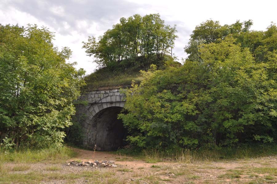
FORT DE COMBOIRE
Built at the end of the 19th century, this is the latest in a series of 6 forts to defend the ancient capital of Dauphiné (the others are Saint Eynard, Murier, Bourcet, montagne de 4 seigneurs and Montavie).
CEMENT STONE QUARRIES
The rock of Comboire conceals a veritable network of underground galleries, dating back to the quarrying of cement stone by the Vicat company, founded by the inventor (Louis Vicat) of cement in 1827.
Rates
Free access.
Opening periods
All year round.
Equipments and characteristics
- Pets allowed
Access
ACCESS : bus stop 21 "Col de Comboire
- Latitude: 45.139623
- longitude: 5.673243
Environnement
- Close to a public transportation
Track characteristics
- Distance:
- 5 km
- Positive level difference:
- 300 m
- Daily duration:
- 2 h 15 min
- Level:
- Level green – easy
- Type:
- Loop


