Crossing the Vouillants
Climb up to Ferme Froussard to discover the most beautiful sites and trails in Les Vouillants. Beautiful views of the Chartreuse and the valley between Pré Faure and Ferme Raymond.
-
Crossing the Vouillants
Départ : Parc de la Poya - Fontaine
Rue de l'Abbé Vincent
38600 FONTAINE
Route
- Languages: Fr
Step by step
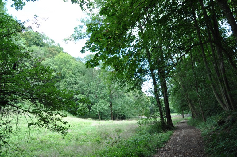
As soon as you get off the streetcar, turn into rue de l'abbaye, skirting the perimeter wall of the beautiful Parc de La Poya. Before continuing uphill, turn left into rue de l'abbé Vincent to admire a well-restored sundial. Continue up rue de la Poya and you'll soon come to the start of the path. The shady climb skirts the cliffs, which are equipped with climbing routes, up to the famous "coup de sabre", a geological curiosity in the shape of a fault through which the path winds. As soon as you leave the path, a glance to your left reveals the height you've already gained over the Grenoble metropolitan area, with Néron and Mont Rachais in the background. Once past the cliffs, the forest gradually becomes thicker, made up mainly of hardwoods such as maples, oaks and hornbeams. After crossing a first forest track, continue up through the forest, dotted with large limestone boulders encrusted here and there with flint nodules. A second track, quickly crossed, then marks out the route, which becomes progressively less steep. The path soon reaches its highest point and reaches the ruins of the Froussard farm, which occupies a beautiful clearing. Turn right towards Pré Faure. The easy track leads to cultivated fields, which the path skirts to the left, in the direction of the Raymond farm. Turn left at each of the few intersections. Above the farm, turn left along a path for 60m to the old ball-trap, then right for 170m, staying right until you cross a forest track. Go straight ahead and stay on the track until it joins the road at the Vouillants hamlet. Follow the road for 350m before forking left onto the track. The last 100m of ascent is on a steep, winding path to Parc Karl Marx, where bus 20 passes nearby.
Rates
Free access.
Opening periods
All year round.
Equipments and characteristics
- Pets allowed
Access
BUS ACCESS: DEPARTURE: streetcar A stop "La poya" ARRIVAL: bus 20 stop "Karl Marx
- Latitude: 45.195759
- longitude: 5.671619
Environnement
- Mountain location
- Close to a public transportation
- Bus stop < 500 m
Track characteristics
- Distance:
- 6 km
- Positive level difference:
- 400 m
- Daily duration:
- 2 h 30 min
- Level:
- Level bue - Medium
- Type:
- Round-trip


