Loop of Chamechaude
Suitable for experienced walkers only, this loop up to the peak of the Chartreuse mountains is an alternative to the simple path to and from the Col de Porte.
Read more Read less
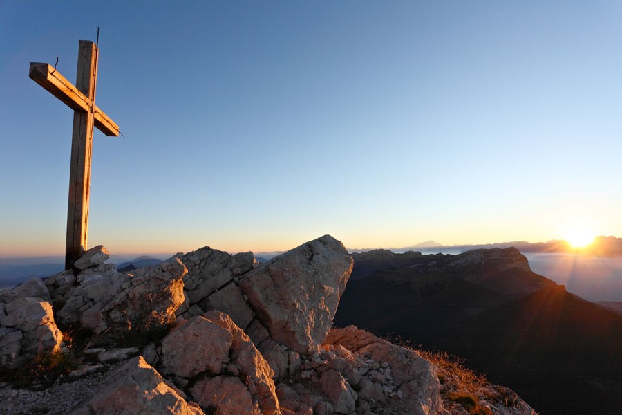
From Le Sappey Eglise, go to the hamlet of La Charmette (1), follow the signs and yellow markings to Le Habert de Chamechaude. At Jailleres, continue straight on. At Le Bruchet, continue towards Le Habert de Chamechaude. At Le Habert, turn left (2). At the Cabane de Bachasson (3) (the only watering place on the route), follow "Chamechaude". From here, the route to the summit (4) is a round trip. Back at the Bachasson hut, turn right and follow "Col de Porte". At the pass (5), take the yellow, red and white signposted path (GR 9) on the left towards "Le Sappey Église".
When the forest track joins the road, follow it for 30 m and turn right down the Chemin des Chartreux (yellow markings). At the last crossroads, follow "Le Sappey l'Eglise" to reach the start (6).
Things to see/do near the route:
- Musée Arcabas en Chartreuse (13 km from the start): St Hugues church.
- Badiane Créations (14 km from start): clothing creations.
- Musée de la Grande Chartreuse (15 km from the start): audio-guided tour.
For more information and other tour ideas, visit chartreuse-tourisme.com/rsf
Information / safety :
- to make the most of your walks and hikes in complete safety, it's a good idea to adopt a few rules and follow a few tips! Before setting off, follow our recommendations and advice on chartreuse-tourisme.com/conseils-rando-trail (or on request from tourist offices).
- A mountain leader is a specialist in mountain fauna and flora, off-trail hiking away from the crowds, local history, alpine and farming traditions, etc. in complete safety! Just ask! Detailed list on chartreuse-tourisme.com/accomp (or at tourist offices).
- You hike under your own responsibility. Chartreuse Tourisme and the tourist offices cannot be held responsible for the itineraries proposed.
Useful numbers :
- Meteo (please consult before setting off): 3250 or www.meteo.fr
- Mountain rescue: 112
-
Loop of Chamechaude
Départ : Sappey Eglise
38700 LE SAPPEY-EN-CHARTREUSE
Route
- Languages: Fr
Step by step
At the hamlet of La Charmette (1), follow the road signs
and the red and white GR9 signs for Le Habert de Chamechaude. At Jailleres, continue straight on. At Le Bruchet, follow the GR9 towards Le Habert de Chamechaude. At Le Habert, turn left (2). At the Cabane de Bachasson (3) (the only watering place on the route), follow "Chamechaude". From here the route to the summit (4) is a round trip. Back at the
cabane de Bachasson, turn right and follow "col de Porte". At the pass (5), take the yellow and red
yellow and red path (GR de Pays) towards "Le Sappey Église".
When the forest track joins the road, follow it for 30 m and turn right down the Chemin des Chartreux (yellow markings). At the last crossroads, follow "Le Sappey l'Eglise" to reach the start (6).
Rates
Free of charge.
Opening periods
From 01/05 to 30/11 daily.
Equipments and characteristics
- Pets refused
Access
Accès en transport en commun (depuis Grenoble) : Bus N62 (TAG) / Arrêt "Sappey-Place"
Départ : Parking du foyer de ski de fond
- Latitude: 45.258000
- longitude: 5.778600
Environnement
- Close to a public transportation
- Bus stop < 500 m
Track characteristics
- Distance:
- 16 km
- Positive level difference:
- 1330 m
- Daily duration:
- 5 h
- Level:
- Level black - very hard
- Type:
- Loop

