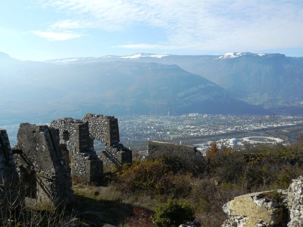
Crossing of Mont Jalla
A unique view of the Grenoble area from Mount Jalla and the memorial of the mountain troops.
-
Crossing of Mont Jalla
Départ : Jardin des Dauphins
38000 GRENOBLE
Route
- Languages: Fr
Step by step
1. From the entrance to the Jardin des Dauphins (please note garden opening times: 9 a.m.-8 p.m. in summer and 9 a.m.-6 p.m. in winter), climb up to the Bastille (sentier de la Mémoire et de la Paix) via the garden paths. From the Guy-Pape garden, the itinerary is a succession of paths, staircases and passages through the fortifications.
2. From the dungeon courtyard (below the cable car entrance), exit through the postern and turn right onto the trail towards Mont Jalla (junction with GR® 9) (caves known as the Mandrin caves). Before the Père Gras inn, turn left onto the fire-fighting track that climbs to the summit of Mont Jalla (630 m). Reach the crest (post "La Chenaie").
3. Leave the GR® 9 and head left towards the memorial, as far as the "Mont Jalla" post (national memorial to mountain troops). Turn right onto a steep path, descending rapidly to Mas Gachet. Descend by the road for about 300 m (view of the Aiguille de Quaix).
4. Turn left along a housing estate. At Gomma, cross the D57 to go straight ahead on a wide, undulating path through undergrowth. Cross two small bridges and climb up to Gatinet. Take the small road to the left, round the Château de Narbonne and continue downhill for about 150 m.
5. Along a hedge, take a path on the left (sunken road, steep descent) to Le Canet. Cross the road and descend to Pique Pierre via Place des Compagnons Charpentiers, Chemin de la
Cheminée and route de Narbonne 6
You can walk back to the Esplanade along the cycle path that runs alongside the Isère river.
Rates
Free access.
Opening periods
All year round.
Subject to favorable weather.
Equipments and characteristics
- Pets allowed
Access
Départ > Tram E : arrêt Esplanade.
Arrivée > Tram E : arrêt Saint-Martin-le-Vinoux hôtel de Ville
- Latitude: 45.193434
- longitude: 5.720327
Environnement
- Close to a public transportation
- Mountain view
Track characteristics
- Distance:
- 9 km
- Positive level difference:
- 600 m
- Daily duration:
- 3 h
- Level:
- Orange level - quite hard
- Type:
- Round-trip
See also
-
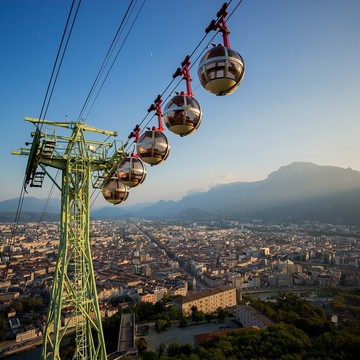
Grenoble Bastille cable car
View more

