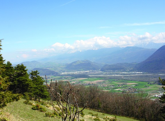
The Echaillon pass and the Uriol ridges from Saint-Paul-de-Varces
The tour of the Pieu from St Paul de Varces
-
The Echaillon pass and the Uriol ridges from Saint-Paul-de-Varces
Départ : la mairie
40 Place de l'Église
38760 SAINT-PAUL-DE-VARCES
Route
- Languages: Fr
Step by step
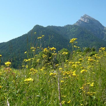
Departure is from the Saint-Paul-de-Varces town hall parking lot. From the Saint-Paul-de-Varces signpost, turn right onto the Charrière Chaude road towards Prélenfrey and Ongrie. At "Ongrie", go straight on for 1 km, then turn left towards "Pont du Batou". Go down the road and cross the "Pont du Batou". Immediately after the bridge, take the right-hand path towards Prélenfrey. Follow the path to the end of a large track at "Les Rioux". Continue straight on up to "Gros Moran" for 400 m. At Gros Moran, take the left-hand track towards Echaillon. Climb to the end of the field and take the flat "Pierre Grosse" path to the Col de l'Echaillon. At the "Col de l'Echaillon", start to descend the track for about 20 m towards "Le Gua", then take the left-hand path towards "Vif" and "Uriol". Climb the forest track which leads to meadows offering exceptional panoramic views. Follow the path along the edge of the meadows for 3 km to "Uriol". At "Uriol", turn left onto the track leading to "St Paul de Varces" and "Crêtes d'Uriol" for 350 m. Then leave the track and take the path on the right towards "Crêtes d'Uriol" for 17O m, then take the small path on your left. Turn right in the direction of "Crêtes d'Uriol" when this path joins the track. Continue along the track for 150 m and turn left onto the path leading up to the Crêtes d'Uriol. At "Crêtes d'Uriol", continue downhill towards "Brise Tourte". Be sure to follow the paint markings, and take care not to take the left-hand path blocked by a cross. Follow the path down to "Brise Tourte", then turn left onto the narrow, winding, steep path, some of which leads to the "Forêt du Gerbier". At "Forêt du Gerbier", don't cross the La Lampe torrent again, but go down 10 m and take the small, winding path on the right towards "Le Charmas". At "Le Charmas", turn left onto the track, emerge onto the road and follow the signs for "St Paul de Varces" all the way to the finish. From chemin du Charmas, continue straight ahead on chemin des Bérards. Turn left onto chemin du Bémont and right onto chemin neuf until you reach the end of the route du Vercors. Turn left and return to the starting point.
Rates
Free access.
Opening periods
All year round.
Subject to favorable weather.
Equipments and characteristics
- Pets allowed
Access
ACCESS : line 46 Stop : Place, Saint-Paul-de-Varces
- Latitude: 45.071978
- longitude: 5.643242
Environnement
- Mountain location
- Close to a public transportation
- Bus stop < 500 m
- Forest location
Track characteristics
- Distance:
- 13 km
- Positive level difference:
- 766 m
- Daily duration:
- 5 h 30 min
- Level:
- Level bue - Medium
- Type:
- Loop
See also
-
Parc Naturel Régional de la Chartreuse
View more

