Le Pré du Playnet
Un itinéraire sur les contreforts est du Vercors avec un parcours de crête passant par la prairie du Playnet, offrant un panorama exceptionnel sur le Trièves et le Dévoluy.


-
Le Pré du Playnet
Départ : parking de la Mairie
Miribel-Lanchâtre
38450 MIRIBEL-LANCHÂTRE
Route
- Languages: Fr
Step by step
1. From the parking lot, take the small road towards Col de Soliet as far as the "Les Anémones" sign.
2. Turn left towards Prélenfrey/Chatelard. The path descends into the forest (in wet weather, take the path alongside the track), then crosses a clearing (panoramic view of Les Deux Sœurs). The route joins the D8B; cross it and follow it for 100 m. At Arzelier, leave the road and take the path on the right towards Prélenfrey. Continue downhill through the forest to the "Chatelard (1,006 m)" sign.
3. Cross the D8B to the right in the direction of Combe Ravier, then head up the undergrowth track (several paths, follow the yellow and green markings). Around 900 m before the crests, the track becomes steep (take care in wet weather).
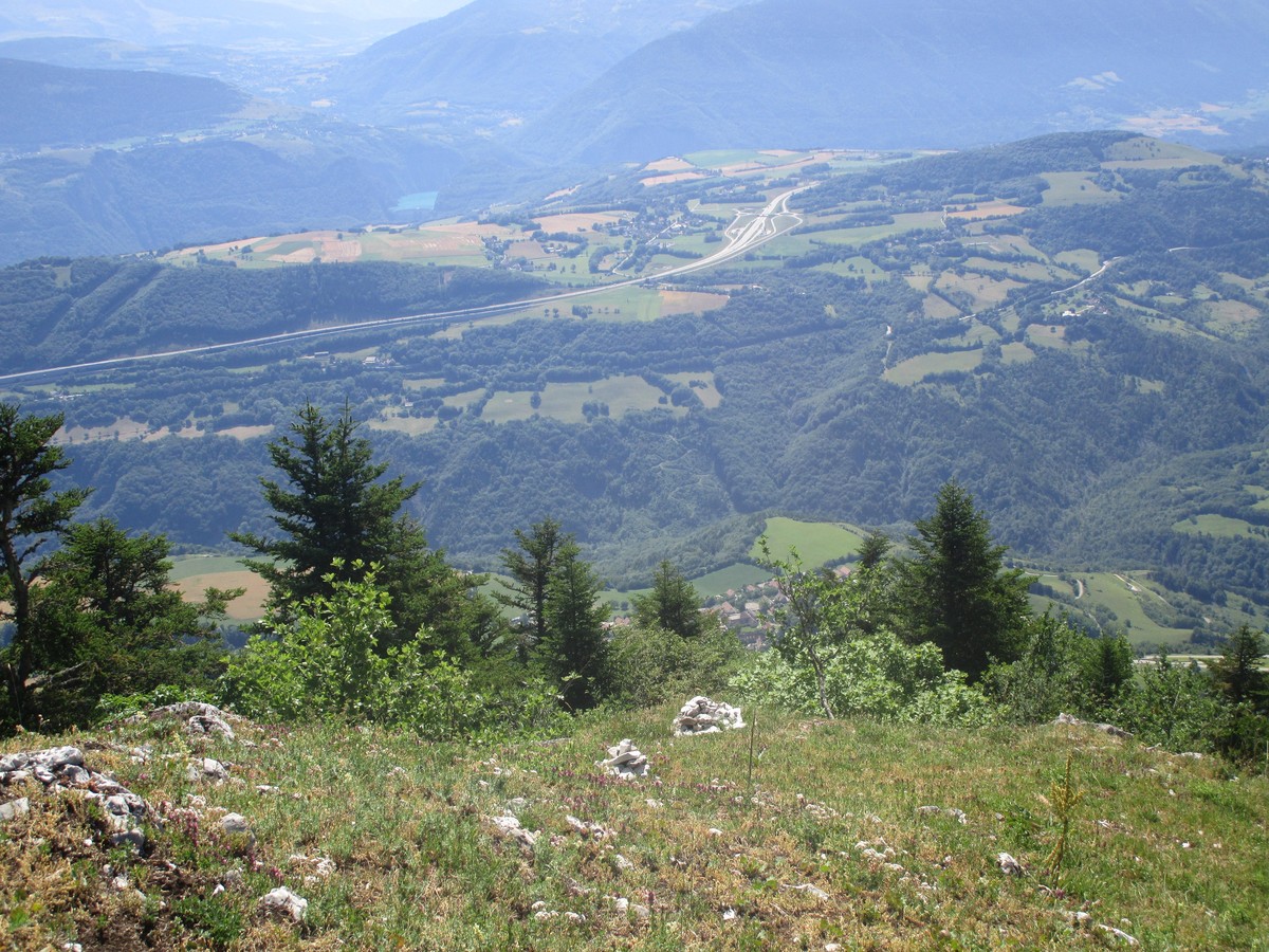
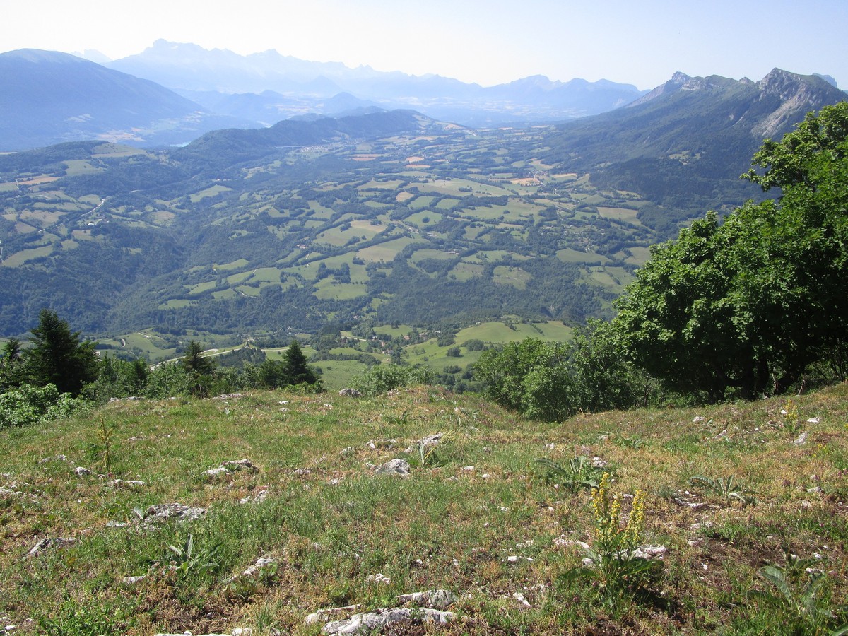
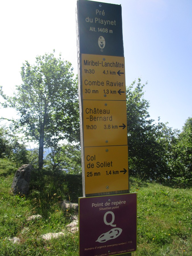
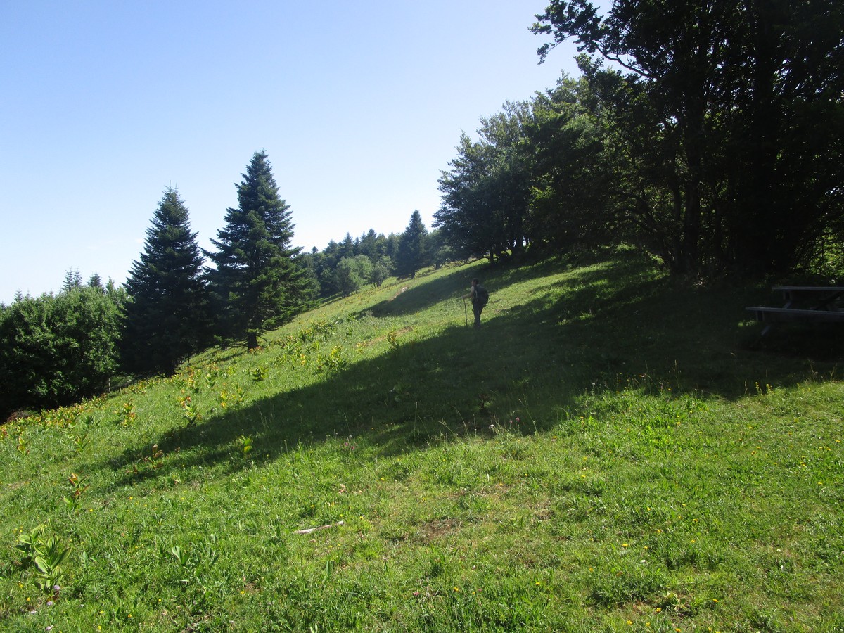
4. At the "Combe Ravier (1,230 m)" post, continue along the ridges towards Pré du Playnet. After a series of steep switchbacks through a forest of fir and beech, the path skirts the cliffs (take care!) and opens out onto a wide meadow at Playnet (panoramic view of all the surrounding massifs). Continue to the "Playnet (1,468 m)" signpost (picnic table).
5. Leave the ridge path and descend towards the Col de l'Arzelier. The descent continues through the forest before reaching a clearing just before the pass (view of the Deux Soeurs and the Col de l'Arzelier).
2. At the "Les Anémones" sign, turn left to reach the parking lot.
Rates
Free access.
Opening periods
All year round.
Subject to favorable weather.
Equipments and characteristics
- Pets allowed
Access
Depuis Grenoble, prendre l'A51 vers le Sud, sortir à la sortie 12 vers Vif. Traverser Vif puis prendre la D8 direction Miribel - Lanchâtre.
Col de l’Arzelier, à 35 km au sud de Grenoble par les A 480, A 51, D 1075, D 8 et D8b.
- Latitude: 44.975353
- longitude: 5.619926
Track characteristics
- Distance:
- 7 km
- Positive level difference:
- 510 m
- Daily duration:
- 3 h
- Level:
- Level red – hard, For experts / practiced
- Type:
- Loop
