Hiking Lac Luitel & la Tourbière area
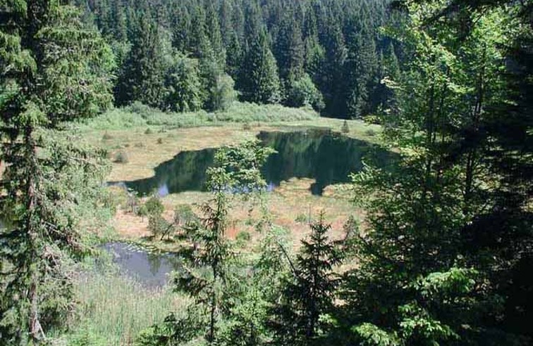
A hike that takes you along the banks of the Romanche to the unspoiled natural area of the Tourbière du Luitel. A route of 5:40, of a good level over 16 km with a cumulative elevation gain of 1000 m (altitude 1380 m).
Read more Read less
1 / Departure from the town hall of Séchilienne: follow the D 113 for about 200 m. On the left, take a small lane then a path that climbs and crosses the D 113. Note: the ruins of the Alleman castle: a datan from the Middle Ages, belonging to the Alleman family until the 16th century, it is a place which served as a refuge during the Resistance.
2 / Opposite, take the Luitel ascent route first via Les Pavies following the markings, then via Les Aillauds, les Blancs and les Nodes before reaching the Gorge. Note: the gîte at the Gorge. After crossing the road to continue opposite, take a path that cuts a bend. Arrived at the entrance to Les Clos, continue following the D113 for about 500 m.
3 / Arrived at l'Echarina, on the right, follow the path until a track joining the Cross, through the woods and meadows. Follow the D 113 then arrive at the Maison de la Réserve, turn left of the building and take a path passing through the undergrowth, overlooking Lake Luitel, for around 200 m, then joining Chemin Vernet, then a crossroads where a precise indication "Lac du Luitel".
4 / Follow the Chemin Vernet (direction Mont-Sec) then pass the Pagnot hut for about 400 m. Note: the magnificent view of the Chartreuse de Prémol. Turn left just before a "hairpin bend", via the source of Globasse, la Roche, then la Croisée. Note: magnificent views over the Romanche valley and the Taillefer massif). Descent to the Col de la Madeleine before following, on the right, a track joining the route de Séchilienne.
5 / Continue to descend, on the left, following the road for about 300 m before taking, still on the left, a steep path, direction Séchilienne, which, after having cut the road several times, allows you to join the Thiebauds .Follow the road uphill for several meters and turn left, in the hamlet, a path which joins the hamlet of Bathie. After having crossed it, continue the descent, crossing small roads several times.
6 / Near Chamoussières, turn left to descend to Mouniers then follow the D 113 for about 300 m to end up taking the path on the right and return to the Town Hall.
Dénivelé: 365m-Durée de la randonnée: 5h40-Niveau: bon niveau. Balisage: jaune
Randonnée fortement conseillée par beau temps principalement
-
Hiking Lac Luitel & la Tourbière area
Départ de la mairie de Séchilienne
38220 SÉCHILIENNE
Route
- Languages: Fr
Rates
Gratuit
Opening periods
Toute l'année mais plus approprié à partir du printemps
Equipments and characteristics
- Pets refused
Access
Départ de Séchilienne: place de la Mairie (parking)
Accès: rejoindre Séchilienne, 28 km au sud-est de Grenoble, par l'Autouroute A80, les nationales N 85 et N 91.
- Latitude: 45.044138
- longitude: 5.826474
Track characteristics
- Distance:
- 16 km
- Positive level difference:
- 1000 m
- Level:
- Level red – hard
Good deal
Intérêts touristiques du parcours: la réserve naturelle du Luitel, qui correspond à la 1ère réserve naturelle créee en France (1961).17 hectares de zone strictement préservées avec des consignes à respecter pour les visites sur le site. Une flore riche de 250 espèces (dont 3 plantes carnivores protégées)- château des Alleman- panoramas.De façon élargie, dans la région: château de Vizille et son domaine, la chapelle XIè siècle de Séchilienne.


