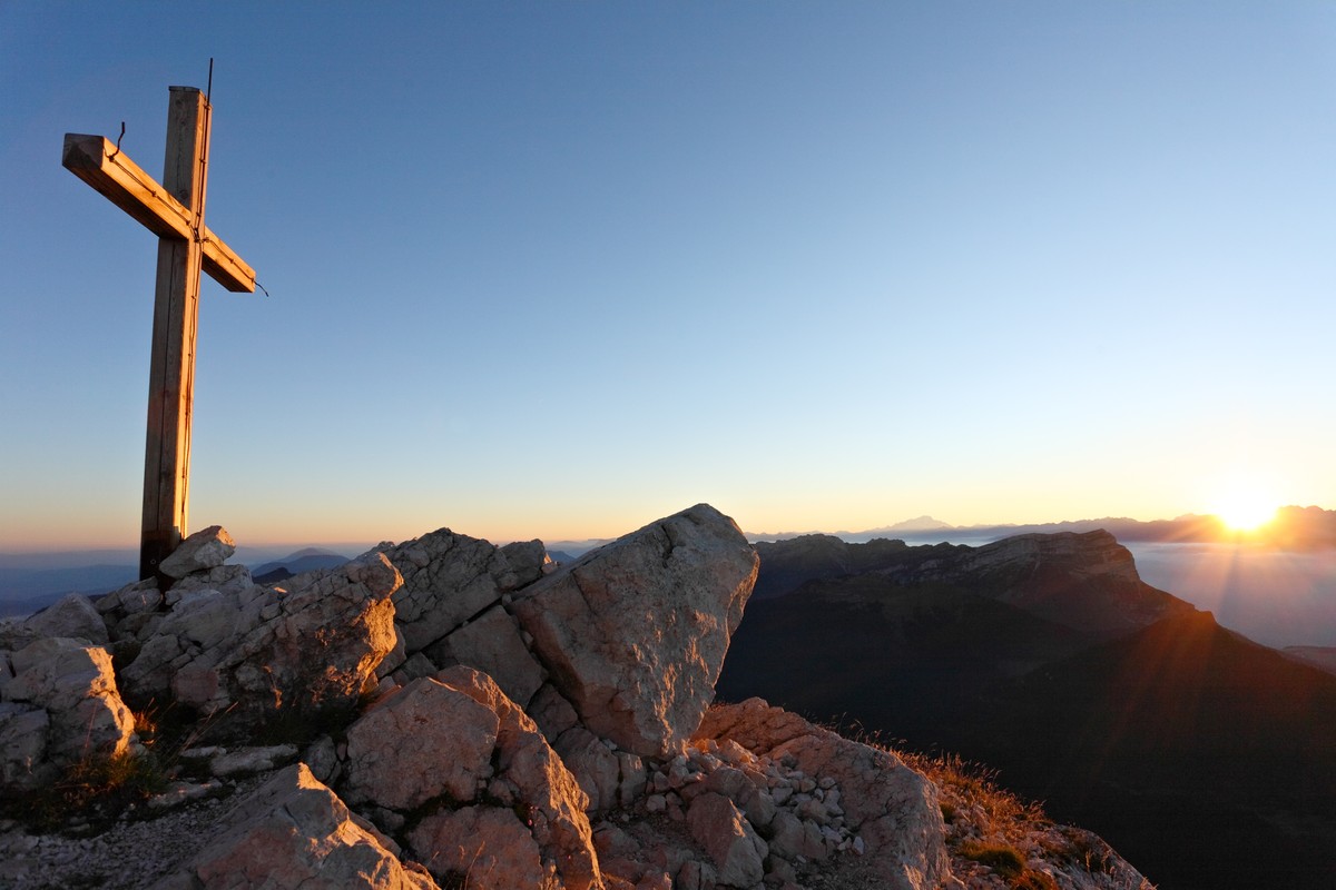
Chamechaude - Summit
Chamechaude is the highest peak of the Chartreuse massif (2082m). Privileged place for all those who like the difference in height. It offers an exceptional panorama.
Read more Read less
Fermeture temporaire du sentier balisé entre la cabane de Bachasson et le Habert de Chamechaude suite à un éboulement vers le secteur Pré Boiteux.
Au départ du parking du Col de Porte, se diriger vers le foyer de fond et suivre la direction "Cabane de Bachasson". Le sentier longe, dans un premier temps, la prairie puis bifurque rapidement en forêt jusqu'à la cabane.
De là, poursuivre à gauche en direction de la Folatière et jusqu'au sommet. A la montée comme à la descente, bien rester sur le sentier en forme de "S" pour minimiser l'érosion. La descente se fait par le même itinéraire.
Pour le retour et éviter un aller-retour sur le même itinéraire, prolonger la randonnée en revenant jusqu'à la cabane de Bachasson et poursuivre en direction de Pré Boiteux et jusqu'au Habert de Chamechaude.
Descendre en direction du Sappey en Chartreuse. A Montjalat, rejoindre le Churut puis Le Réservoir. Suivre le GR9 à l'Appanon prendre à droite qui remonte jusqu'au Col de Porte.
A voir / à faire à proximité de l'itinéraire :
- Petits Jardiniers (à 5km du départ) : culture de plantes médicinales.
- Musée d'Art Sacré Contemporain (à 8km du départ) : église de St Hugues.
- Musée de la Grande Chartreuse (à 10km du départ) : visite audioguidée
- Fort du St-Eynard (à 10km du départ) : visite du fort et panorama exceptionnel.
Toutes les infos et d'autres idées de visites sur chartreuse-tourisme.com
Informations / sécurité :
- il convient d'adopter quelques règles et de suivre quelques conseils pour profiter pleinement de vos balades et randonnées en tout sécurité ! Avant de partir, suivez nos recommandations et conseils sur chartreuse-tourisme.com/conseils-rando-trail (ou sur demande dans les offices de tourisme).
- A savoir : l'accompagnateur en montagne est un spécialiste de la faune et la flore en montagne, des randonnées hors des sentiers à l'écart de la foule, de l'histoire locale, des traditions alpines et paysannes, etc. en toute sécurité ! Faites appel à eux ! Liste détaillée sur chartreuse-tourisme.com (ou dans les offices de tourisme).
- Vous randonnez sous votre entière responsabilité. Chartreuse Tourisme et les offices de tourisme ne sauraient être responsables des itinéraires proposés.
Numéros utiles :
- Météo (à consulter impérativ
Step by step
From the Col de Porte parking lot, head towards the cross-country fireplace and follow the signs for "Cabane de Bachasson". The path initially skirts the meadow, then quickly forks into the forest to reach the hut.
From here, continue left towards La Folatière to the summit. On both the ascent and descent, keep to the S-shaped path to minimize erosion. The descent follows the same route.
For the return journey, and to avoid a return trip along the same route, extend the hike back to the Bachasson hut and continue towards Pré Boiteux and on to Habert de Chamechaude.
Descend towards Le Sappey en Chartreuse. At Montjalat, join Le Churut then Le Réservoir. Follow the GR9 at Appanon and turn right up to Col de Porte.
Things to see/do near the route:
- Petits Jardiniers (5km from the start): medicinal plant cultivation.
- Musée d'Art Sacré Contemporain (8km from the start): St Hugues church.
- Grande Chartreuse Museum (10km from start): audio-guided tour.
- Fort du St-Eynard (10km from the start): tour of the fort and exceptional panorama.
All the info and other ideas for visits on chartreuse-tourisme.com
Information / safety :
- to make the most of your walks and hikes in complete safety, it's a good idea to adopt a few rules and follow a few tips! Before setting off, follow our recommendations and advice on chartreuse-tourisme.com/conseils-rando-trail (or on request from tourist offices).
- A mountain leader is a specialist in mountain fauna and flora, off-trail hiking away from the crowds, local history, alpine and farming traditions, etc. in complete safety! Just ask! Detailed list on chartreuse-tourisme.com (or at tourist offices).
- You hike under your own responsibility. Chartreuse Tourisme and the tourist offices cannot be held responsible for the itineraries proposed.
Useful numbers :
- Weather (please consult
Rates
Free of charge.
Opening periods
From 01/05 to 30/11 daily.
Subject to favorable weather.
Equipments and characteristics
- Pets refused
Access
Access without a car: from Grenoble, take the N62 bus in the direction of Col de Porte, get off at Col de Porte (stop only on weekends, public holidays and vacations). Bus reservations recommended. Information and booking: https://www.reso-m.fr/
- Latitude: 45.289754
- longitude: 5.767091
Environnement
- Close to a public transportation
- Bus stop < 500 m
Track characteristics
- Distance:
- 7 km
- Positive level difference:
- 750 m
- Daily duration:
- 5 h
- Level:
- Level red – hard
- Type:
- Round-trip
