Bachat-Bouloud climbing site

Bachat-Bouloud school climbing site (Village du Bachat)
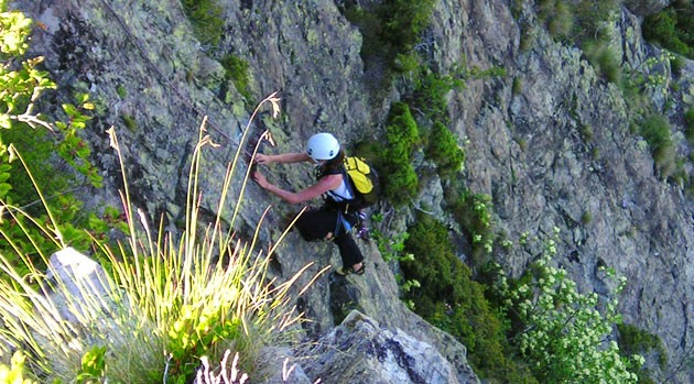
Rocky ridge appropriate for beginners thanks to its close holds and its easy routes level.
Read more Read less
Spot in Chamrousse 1700
Practical level : beginners (grade from 3 to 5c)
Approach time : 10 mn
Favourable time : from May to October
- Range : Belledonne
- IGN map : 3335 OT
- Altitude : 1700 m
- Rock : gneiss
- Number of routes : 152
- Minimum height of the routes : 3 m
- Maximum height of the routes : 22 m
- Rock practise : walls, slabs with blocks, few overhangs
- Rock Orientation : severals
Because of this area which is part of the Arselle's plateau, but also the landscape, botanic and faunfaunistics, the plateau is a protected natural reserve. There is a prefectorial decree for its biotope. The aim is to preserv it this area, from its flora to its fauna.
It is your responsibility to assess your climbing ability. Respect safety rules. Check your equipment.
NOTES :
> Recommended rope length: 45m
> Rocks 7 and 12 are equipped only for windmills. All others are mostly equipped for lead climbing, and are indicated in the route list: Equipped for lead climbing.
> The top of the boulders are easily accessible for setting up moulinettes. Beware of reckless children.
-
Bachat-Bouloud climbing site
Chamrousse 1700
38410 CHAMROUSSE
Route
- Languages: Fr
Rates
Free access.
Opening periods
From 01/05 to 31/10.
Open all year round - accessible depending on snow conditions.
Equipments and characteristics
- Pets refused
Access
From the Bachat-Bouloud parking area (next to the tree climbing activity), go to the East and find the forest track in a hairpin turn road.
From the start of the track, you will find a sign writen "réservation" with a map instead of situated yourself. This sign was used at the time of Bachat-Bouloud holiday camp.
Some blocks are set up with slingshot systems (7, 10bis and 12)
Recommended rope of 40m long.
- Latitude: 45.104032
- longitude: 5.884530
Environnement
- Mountain location
