La Cuche between freshness and sun
To go around the Cuche at the extreme north of the Vercors, is to survey between adret and ubac, between the waters of the Voroise and the summit meadows, all the facets of a summit. And even if the slopes can be steep, the pleasure is there.
-
La Cuche between freshness and sun
DÉPART : place du Perron
38113 VEUREY-VOROIZE
Route
- Languages: Fr
Step by step
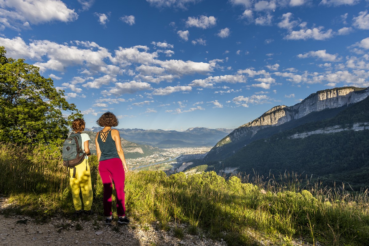
Beautiful view of the Grenoble Y on a clear day. One of the best views of the Grenoble Y.
From Place du Perron (alt. 230 m), follow the yellow signs up "rue de la Gibertière" towards Emporey. After approx. 200 m, turn left onto a path that leads to the Voroise stream,
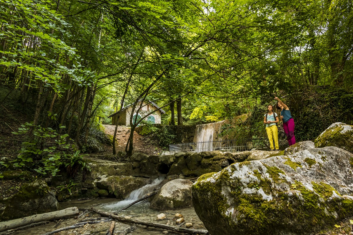
where you cross over to the right bank and continue uphill, with the stream on your right. After a slightly steep uphill section where you pass a beautiful waterfall, you reach an intersection where you turn right, descending slightly.
slightly downhill. The trail is a roller-coaster ride, moving away from and towards the river, until you reach Fond Chaude (alt. 430 m). La Cuche is signposted at 2.8 km. Here you leave behind the Voroise stream,
and begin a long, sustained climb with a 400 m vertical drop. Continuing uphill, you arrive at Foraize (alt. 820 m) (warning: blades missing), where you continue straight on towards La Cuche along a less steep path.
The path joins a large carriageable track at the reservoir (alt. 860 m), and you continue uphill on your left along a track surrounded by meadows, with a superb view of the Grenoble conurbation. Continue
on the main track until you reach the La Cuche sign (alt. 930 m). Turn left onto the narrow path towards Veurey-la-Rive, without entering the private property. You then quickly start your descent
down a long series of switchbacks to the road 730 m below, at La Bournay (alt. 190 m). On the road, turn left and, staying on the asphalt with the forest still on your left, reach Les
Cordées, just before the Veurey-Voroise entrance sign. Here, take the left-hand track to Les Jayères, fork left again at the next junction, and when you reach the road, continue straight on towards the town hall to reach your starting point.
back to your starting point.
Points of interest:
- The village of Veurey-Voroise
- The Voroise stream
- The waterfall
- The view from La Cuche
- Meadows
Rates
Free access.
Opening periods
All year round.
Equipments and characteristics
- Pets allowed
Access
Bis bus Flexo 51 Stop Mairie Veurey-Voroize (from there, walk to
the place du Perron)
PARKING : place du Perron in Veurey-Voroise
- Latitude: 45.271839
- longitude: 5.614014
Environnement
- Close to a public transportation
Track characteristics
- Distance:
- 10 km
- Positive level difference:
- 780 m
- Daily duration:
- 4 h 40 min
- Level:
- Level red – hard
- Type:
- Loop
