The mountain of Uriol
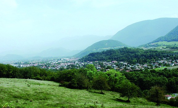
Cette randonnée vous permettra de découvrir le flanc Est d’une belle montagne du Vercors, caractéristique par sa forme de pyramide que l’on découvre lorsque l’on se dirige par l’autoroute vers le Sud.
-
The mountain of Uriol
Départ : 5 Place de la Libération
La mairie
38450 VIF
Route
- Languages: Fr
Step by step
Drive to Vif and park in the Mairie parking lot. Walk 50m along the RD75 to cross the Gresse river. Turn left into an alleyway that runs alongside the former Visitation monastery. The path begins to climb the first few metres of this steep slope. The first junction is quickly left, and you follow the signs for Echaillon. At the next hairpin bend, you'll already have a beautiful panoramic view of Vif and the Reymure plain. Further on, leave the climb to the Rocher Saint Loup estate on your right and continue straight ahead. Follow the path to altitude 650m, pass a gate, then fork left, still heading for l'Echaillon. A few minutes later, you'll come across the sadly ruined hamlet of Uriol, nestled on a hillside. The size of the buildings and the remains of a chapel suggest that there have been many inhabitants on these isolated lands. The path continues southwards, where dry meadows and forests follow one another. Note the Mediterranean character of the vegetation (e.g. downy oak, cotinus or wig tree) on this steep, south-east-facing, dry and warm limestone slope. Here, the path passes right over the old Champrond cement limestone quarries. Further south, you finally straddle the south-facing crest of Le Pieu at an altitude of 900m, before descending on the west-facing slope to the charming hamlet of L'Echaillon (690m). The descent to Les Grand Amieux, via the Pas de l'Echalier, takes place on a wide track. After a few hairpin bends on the small asphalt road, turn left at the reservoir and descend to the Champa micro power station. Follow the road to the village of Le Gua, then turn left towards Champrond/Vif, and finally reach Vif on the left bank of the Gresse.
HISTORICAL HERITAGE: In the 19th century, the Grenoble region experienced a major industrial boom. The invention of cement played a part in this, triggering a rush for cement stone. The Vif and Le Gua areas were quickly identified as being particularly rich in this resource. This prosperous activity had belonged to the VICAT company since 1920, employing 220 people in 1960. From 1973 onwards, the plant was gradually abandoned, closing for good in 1976.
Rates
Free access.
Opening periods
All year round.
Equipments and characteristics
- Pets allowed
Access
ACCESS : bus 25 / C14 stop "Vif-mairie"
- Latitude: 45.056345
- longitude: 5.669052
Environnement
- Mountain location
- Close to a public transportation
- Forest location
- Village -2 km away
Track characteristics
- Distance:
- 13 km
- Positive level difference:
- 800 m
- Daily duration:
- 5 h 30 min
- Level:
- Orange level - quite hard
- Type:
- Loop
