La Pinéa by the Vermorel trail
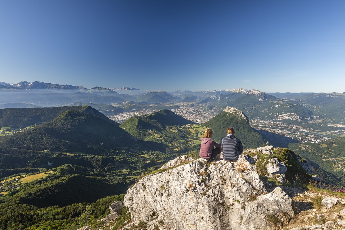
La Pinéa (1771m) isn't the biggest peak but she teases her neighbours, le Charmant Som and Chamechaude. This aerial summit offers an authentic mountain hiking, with an easy to reach and magnificent 360-degree view.
Read more Read less
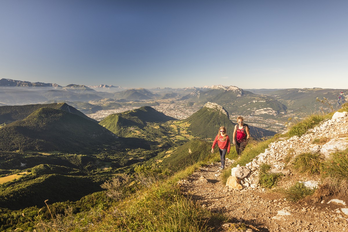
From the signpost at the top of the parking lot, Col de la Charmette (alt. 1265 m), turn right towards Girieu, 3.3 km away. You follow a forest track that goes south following the yellow markings. The track, in a rollercoaster, takes you through the wide crossing of the Fontaine claire (alt. 1260 m) (attention: a broken blade "col de la Charmette"), where you continue to the left, then to a new intersection at point 1321. At the signpost, leave the track and turn left towards Planfay-le-Bas. The sunken road goes down a little, and joins a new half-tarmac track. Continue on this track to reach Girieu (alt. 1 270 m). At Girieu, turn left towards La Pinéa on the Vermorel trail. You quickly leave the clearing to attack more seriously your ascent in the forest. Follow the yellow markings until you reach an old track where the path continues slightly to the right, above, to come to the foot of a large rocky bar. The itinerary continues to the left of this one. Be careful: this is the technical part of your hike. The path, sometimes narrow, passes at the top of rocky bars, and moreover, in wet weather, the ground can become greasy and slippery. After a nice climb, you come out under the west face of the Pinéa that you bypass on the left to reach a weakness north of the summit. Then go back down about 40 meters to take an easier path on the right (attention: the PDIPR sign seems to be under renovation). After a last playful rocky ramp, you arrive at the summit of La Pinéa (alt. 1 771 m). Be careful: the summit is narrow and surrounded by cliffs. From the summit, turn around, and at the intersection that goes back to the Vermorel path, continue your descent straight ahead until the Plénom junction (alt. 1,615 m). You are now on the GR de Pays du Tour de Chartreuse, with yellow and red markings. Follow it straight ahead by the Montfromage ridge in the direction of Charmant Som. You follow the crest without interruption for almost 3 km, then, after a more sustained but short descent and a small flat, you join the road to Charmant Som. On the asphalt, go up to the left to pass in front of the oratory of Orgeval, and reach in 5 minutes the intersection of the alpage of Charmant Som (alt. 1 640 m). Leave the road here, and turn left towards the Col de la Charmette at 2.5 km. The descent is first made on a wide track, then after a wide left hairpin bend, spot on the right at about 1570 m, the path that plunges into the forest. The winding path quickly makes you lose altitude until you reach a new track. You just have to take it on the right to finish your descent to your starting point, the col de la Charmette.
Access : no public transport. Be careful, the Col de la Charmette is not accessible during the winter period from December to March, depending on the weather conditions (the barrier is closed upstream of the Hameau de Pomarey, 5 km from the pass). Please check the road information sites beforehand. This hike is best done from April to mid-November.
See and know : The Charmette pass is located between the Grande Sure to the west and the Charmant Som to the east. The two brooks born near the pass and which go down, one towards the North and the valley of the dead Guiers, the other in the South towards the valley of the Isère, are both called "Tenaison". Many chasms are located in the forest of Génieux near the Col de la Charmette. The deepest is the Génieux chasm, to the west, at an altitude of 1 410 m with a depth of 675 meters.
Points of interest:
- The Vermorel trail
- The mountain forest
- The crest of Montfromage
- The mountain pastures of Charmant Som
- The view from the Pinéa on the Grenoble agglomeration, the Chartreuse and the Vercor massif

-
La Pinéa by the Vermorel trail
Départ : Col de la Charmette
38700 SARCENAS
Route
- Languages: Fr
Rates
Free access.
Opening periods
From 01/04 to 15/11.
Equipments and characteristics
- Pets allowed
Access
ACCESS : car ; parking at the Charmette pass
- Latitude: 45.321991
- longitude: 5.740073
Track characteristics
- Distance:
- 13 km
- Positive level difference:
- 850 m
- Daily duration:
- 5 h 40 min
- Level:
- Level red – hard
- Type:
- Loop
