La Tour-Sans-Venin
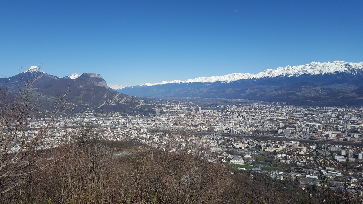
This walk in the hillsides of the Vercors massif will make you cross woods with varied species alternating with meadows offering beautiful panoramas on the Chartreuse and Belledonne.
-
La Tour-Sans-Venin
Départ et arrivée : Parc Karl-Marx, Fontaine
38170 SEYSSINET-PARISET
Route
- Languages: Fr
Step by step
From Parc Karl-Marx, take the steep climb behind the tennis courts towards Les Vouillants. Proceed to the crossroads and turn right onto a road leading to Les Vouillants. At Les Vouillants, turn right onto a path towards Tour Sans Venin. The path crosses a meadow and approaches the cliffs (be careful!). The path enters the forest again, intersecting various forest tracks.
Keep heading for Tour Sans Venin. Join a road at the ball-trap. Continue straight ahead on a good gravel path towards the ruins of the Froussard farm, which you reach after 650 m. Continue straight ahead, through the forest, towards Tour Sans Venin and Pariset. Pass through La Croisée. The path leads to pasture meadows at the ruins.
At Sabot, the path veers to the right, then opens out onto a road at the Sarrasins caves and joins the D106 ("Pariset" sign). Option to climb up to Tour Sans Venin [ruins, orientation table, panoramic view as far as Mont Blanc on a clear day] (20 min round trip; not signposted). Descend along the D106 (caution!) for 400 m towards Seyssinet Village (GR ® 9). Turn left onto a downhill path. Pass Bel Air and continue downhill to Les Arcelles. You can enter the Jean-Jacques Rousseau desert and join the itinerary described at Pré Faure.
Proceed to the entrance to the Jean-Jacques Rousseau desert. In front of the large wooden gates, turn right to continue along the parking lot. At the "J.-J. Rousseau" sign, take the left-hand path to Pré Faure. Follow a gravel path towards Parc Karl-Marx. The path skirts meadows and becomes tarmac at the Raymond farm. Turn right onto the road leading downhill towards Parc Karl-Marx.
At Les Vouillants, take the same route as before and return to the starting point.
Rates
Free access.
Opening periods
All year round.
Subject to favorable weather.
Equipments and characteristics
- Pets allowed
Access
ACCÈS BUS : DÉPART : terminus tram A arrêt ”La Poya” ARRIVÉE : bus 20 arrêt ”Karl Marx”
- Latitude: 45.184978
- longitude: 5.688266
Environnement
- Mountain location
- Close to a public transportation
- Bus stop < 500 m
Track characteristics
- Distance:
- 11 km
- Positive level difference:
- 446 m
- Daily duration:
- 4 h 30 min
- Level:
- Orange level - quite hard
- Type:
- Loop
