By way of Chachatier
In the south of Belledonne, a few miles from Vizille, there are many hidden hamlets, yesterday surrounded by meadows, today under the cover of trees. Chachatier is one of these places already far away and yet so accessible. A haven of peace.

-
By way of Chachatier
POINT DE DÉPART : arrêt de bus Le village
38410 VAULNAVEYS-LE-BAS
Route
- Languages: Fr
Step by step
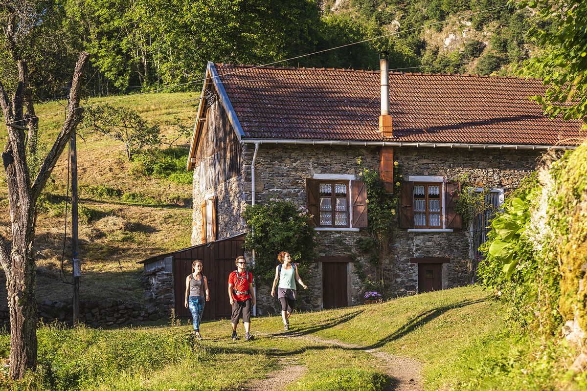
You'll be following yellow markings on this hike. From the "Le village" bus stop - Bus Flexo 23 (Réseau TAG) (alt. 312 m), start up the "chemin de la Mairie" on the road towards Vaulnaveys-le-Bas. In Vaulnaveys-le-Bas (alt. 325 m), at the crossroads above the town hall, turn right towards Les Mailles, still on the road. Follow the asphalt in a straight line, and at the intersection with Chemin des Mailles, turn left up the hill. As the road bends to the left, turn right onto a path towards Les Girouds. The path crosses the undergrowth, then descends slightly to the right to avoid large boulders. You come to the Les Girouds crossroads (alt. 336 m). Go up to the left of a house, in the direction of Le Plâtre, 700 m away. Back towards the houses, continue straight ahead, level, to join a section of road which you leave immediately on the left. You are now at Le Plâtre (alt. 335 m). This is where you really start to climb towards Haut du Plâtre, where you turn left towards Courbière, 1.25 km away. You're off for almost 400 m of sustained, uninterrupted ascent to Courbière (alt. 730 m). On the carriageway,
turn left to reach Chachatier in 2 minutes. After the hamlet's houses, the track takes you over 1.5 km further to new houses. After a slight climb, you come out over meadows and continue downhill to the left, past a concrete water reservoir. The path becomes a small road, and joins a larger one at a sharp bend. Don't stay on the asphalt, and turn left at this bend onto the path towards Vaulnaveys-le-Bas. Continue straight downhill, following the yellow signs for short walks and, back on asphalt, go down the road in front of you to the Les Meyards crossroads (alt. 325 m). Turn left along this road to reach Vaulnaveys-le-Bas town hall, then right at the town hall to reach the road to Vizille and your starting point, the "Le village" bus stop (alt. 312 m).
Points of interest :
- The hamlet of Chachatier
- The forest
- Hay meadows
Rates
Free of charge
Opening periods
Throughout the year : open daily.
Equipments and characteristics
- Pets allowed
Access
PUBLIC TRANSPORT: line 23, Le village stop
PARKING: above Vaulnaveys-le-Bas town hall
Parking: Around 50 spaces at the site entrance
- Latitude: 45.105490
- longitude: 5.800420
Environnement
- In the country
- Mountain location
- Riverside
- Close to a public transportation
Track characteristics
- Distance:
- 8 km
- Positive level difference:
- 450 m
- Daily duration:
- 3 h 15 min
- Level:
- Level bue - Medium
- Type:
- Loop
